Green Space
The amount of designated green space within the Whitby urban area has been eroded over many years, most recently by housing. There are targets set by councils and governments for how much should be provided, though the accessibility is often not allowed for by councils when defining levels; targets for green space provided by the WHO, however, require that such green space be accessible, safe and functional.
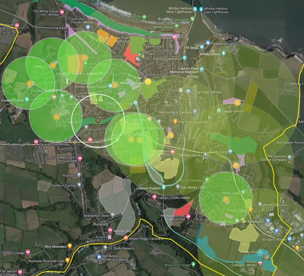
We have mapped the current allocation of Whitby parish green space, and displayed it on the map below, colour coded for the different types of green space, see the Layers on the map “Natural”, “Urban Park”, “Sports”, “Other”, “Allotments”, and “Play Area”.
[If this map does not show, click here for a Google Maps version].
In accordance with our transparency policy, the green space type definitions are downloadable in Keyhole Markup Language (KML), GeoJSON and GPX formats, as follows.
Benefits of Green Space
Green space is of paramount importance to the physical and mental health of residents, and this is backed up by ample evidence. A report by the WHO in 2017 provides guidance on the impact and effectiveness of providing green space and, as this analysis says “The WHO report represents an important step forward. As worrying trends in mental ill-health, obesity, social isolation, health inequalities and environmental degradation grow globally, there is a pressing need to implement equitable solutions – and green space has a key role to play in this. Urban green-space interventions can deliver health, social and environmental benefits for all population groups – particularly among lower socioeconomic status groups. There are very few – if any – other public health interventions that can achieve all of this.”
In a report by Public Health England in March 2020 “Recognising that greener neighbourhood environments convey a disproportionate health benefit to disadvantaged groups, well-planned green infrastructure can be one approach toward reducing health inequalities. This is particularly salient in the context of widening health inequalities in England. Greenspace must be viewed as a critical infrastructure to achieve wider local priorities, and creativity in how it will be funded, managed and delivered to meet the needs of the population.These times require strong local leadership and political will that recognises the true value of local greenspace as essential assets in the delivery of health, social, environment and economic outcomes to ensure greenspace survive and thrive.”. The report stressed the need to treat greenspace as “critical infrastructure” and as being required to meet local priorities. Specifically a local authority should ensure that the Joint Strategic Needs Assessment (JSNA) and Joint Health and Wellbeing Strategy (JHWS) define how local greenspace can be used to meet the current and future health needs of the population, and to ensure that the Local Plan reflects the health priorities laid out in the JSNA and JHWS.
The countryside charity CPRE issued a report in Feb 2022 saying “Green spaces contribute to (i) climate change adaptation and mitigation; and (ii) to the functioning of wider places and systems (such as wildlife corridors, views and settings, and natural drainage areas). see The Environment Act 2021, Accessible Natural Greenspace Standards (ANGSt) are needed to ensure human health, wellbeing and equality”.
In a report by the Director of Public Health for NYCC (2022) it is stated “Support equitable access to green space”, and “Building back ‘greener’ is a key ambition nationally and for local partners, … such as improving green spaces … we can help limit the harmful impacts into the future“.
Urban green spaces improve the health and well-being of residents conferring benefits from the eco-system by
- buffering noise pollution,
- improving air quality – the absorption and shielding from particulate matter (i.e. exhaust from vehicles and smoke from the burning of fossil fuels),
and the removal of carbon dioxide a green house gas. - reduction of flood damage by retaining heavy rain. The role of trees in this function to prevent soil erosion is well established.
- preventing heat stress (shade from trees).
- providing areas for recreation.
Not all green spaces are equal. The greater the biodiversity the greater the health benefits. Grassland is a useful area for recreation. But the increased biodiversity in a flower meadow greatly increases the well-being benefits of the space. The addition of shrubs and trees to a grassed area increases further the visual enhancement and heat stress reduction.
Specifically considering biodiversity, from Scarborough Borough Council (SBC)’s own 2005 Biodiversity Action Plan, where it states “Biodiversity is vital to life and, in its simplest terms, enables life to exist on the earth. The air we breathe, the food we eat, the water we drink, are all linked together in a complex web, every plant and animal having its own small part to play. Even the places we know and the livelihoods that people have are largely dependent on the rich diversity of life around them and together give that sense of place that makes Yorkshire different from Essex or Gristhorpe different from Hunmanby. Change though is a natural and important part of the natural world and development is both inevitable and necessary. It is therefore imperative that such development pays respect to the biodiversity of the region and seeks to maintain and enhance it for our future generations. This is what sustainability is all about“.
In summary, there is consensus amongst a very wide range of organisations (including NYCC and SBC), and local authorities should pay strict attention to this message.
SBC Audit (2014)
The SBC Green Space Audit (2014) assessed the green space in Whitby as it was in 2014. This report equated it to 75 hectares (ha) of open space, sport and recreation, or 5.6ha per 1000 population, and a third of the sites graded for quality failed to meet the standard required for their types (if something doesn’t meet a required standard, doesn’t that mean that it should not be counted?). This audit did not make any special allowance where green space was not publicly accessible, and hence ineffective (whether due to being very steep, or being fenced off).
Amongst the observations and recommendations of that audit
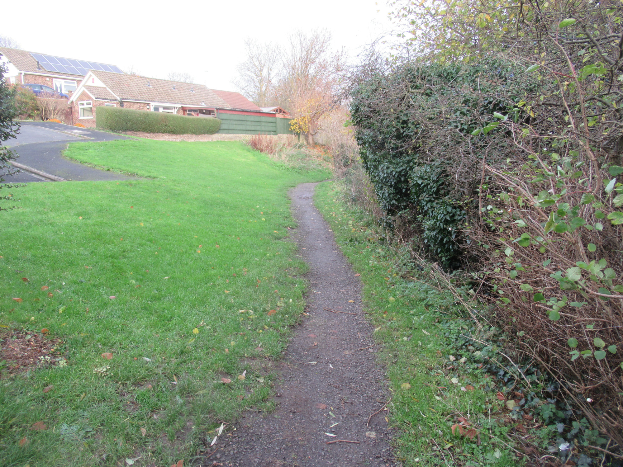
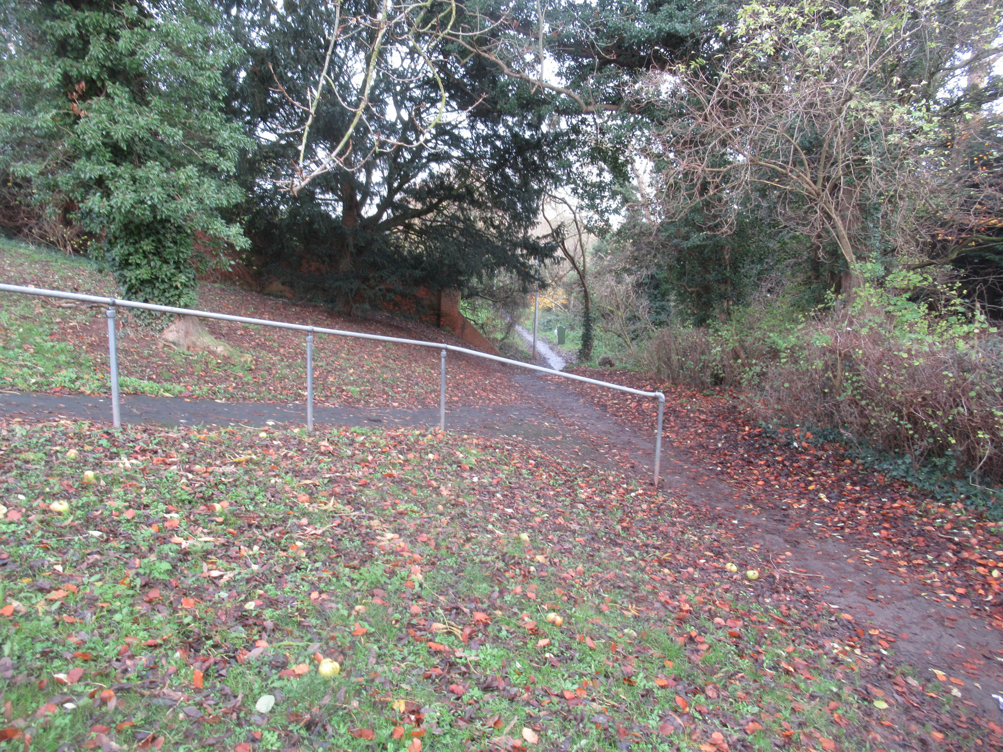
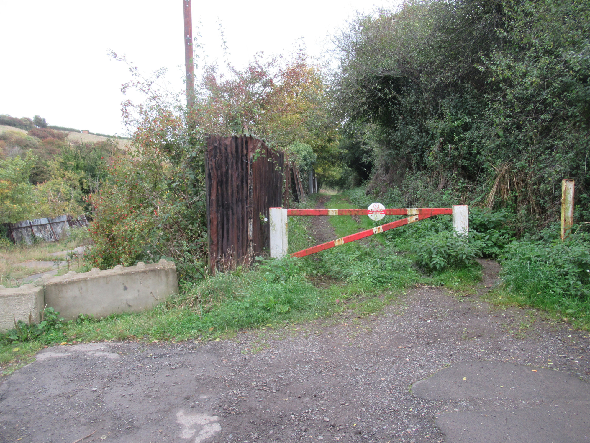
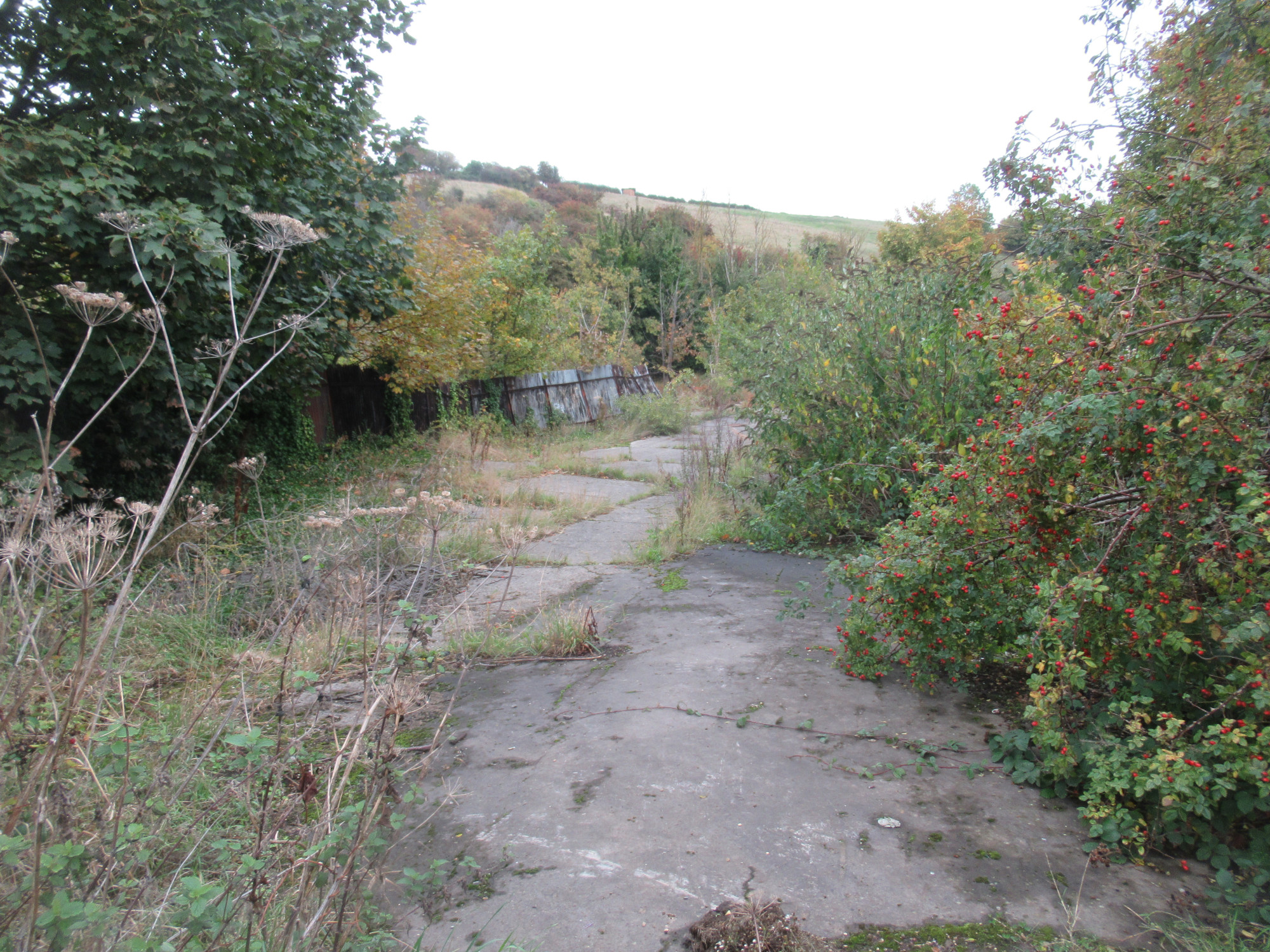
- Desire to enhance the quality of Stakesby Vale, which was rated as poor. Nothing has changed with Stakesby Vale in the intervening 8 years, other than further deterioration of the path through that area, with the area discriminating against disabled people also. See this proposal for provision of a shared walking / cycle path through that area.
- Seek to enhance the quality of Tuckers Field (paddling pool etc), which also didn’t meet the required quality. In May 2025 a Pump Track opened, which improved one part of this space. Similarly on the other side of Tuckers Field the tennis courts were brought back in to use. Little has been done around the paddling pool area, and parts of it are actually used as an overflow car park by NYC. See our proposal to have a shared walking/cycle path across Tuckers Field as well as along West Cliff.
- Provision of natural green space was below the local standard, with a deficiency of 5.5ha, though SBC (in the report) thought that this is offset by the proximity of the NYMNP, however many people don’t have transport, and to have to use transport just to reach natural space is an excessive obligation (the equivalent country parks in Filey and Scarborough are significantly closer). Additionally, the rules of a national park are not the same as for natural green space in a town, and a national park is not comparable to a country park, like what is provided for Scarborough and Filey residents.
- The audit notes that “Natural Parks and Green Spaces in Whitby are accessible”, though note that this simply means the green spaces are “within reach” (a nominal walking distance, which is not necessarily approriate for elderly people) of residential. It does not mean that they are accessible with respect to less able-bodied residents for example (Stakesby Vale has steps to enter the area, West Cliff has gradients of up to 45 degrees and much of the area is definitely not for use by the public, school sports fields are not accessible for the public except within the scope of a club), and in fact totally ignores this definition of accessibility.
- Provision of urban green space was below the local standard, with a deficiency of 6.2ha, particularly in the Helredale area. There has been no further provision since then.
- Provision of other green space was above the local standard with a surplus of 5.6ha, and this could be used to fulfil the deficiencies in other categories, however land around Highfield Road (1.1ha) has been lost since the audit, as has Helredale playing field (1.6ha).
- Provision of sports green space exceeded the local standard, however Helredale playing field (1.6ha) has since been sold off for housing. Larpool playing field was of poor standard back then and nothing has been done to correct this. There was a lack of green space for ad-hoc sports for residents around the Mayfield area (no amenity space, nearest accessible sports at White Leys or Larpool!).
- Helredale Playing Field was categorised as both Other and Sports, that means this area was doubly accounted for!
- It is unclear whether the following were included : East Whitby Primary Academy has a sports field (0.6ha), West Cliff Primary has a playground (0.1ha), and Whitby RC Primary School had 2 sports fields (0.6ha).
- It made no allowance for accessibility of individual green space areas. Both the WHO and Ordnance Survey definitions of green space consider accessibility to be a key aspect and to ignore this leads to an erroneous representation of utility of the space.
- The area for secondary schools (Caedmon College, Caedmon Sixth Form and Eskdale School) are to cater for the whole travel-to-work-area (TTWA), so their green space area should be scaled by 13213/25000 to get the Whitby parish component.
- 0.8ha of Tuckers Field (bowls/tennis) is used regularly as overflow car parking, and so should not be included in any “green space” calculation. It is either green space (in which case prohibit parking, or it is parking (in which case it is not included in a green space audit).
Changes since 2014
Since the most recent council audit (2014), the West Cliff area has further deteriorated, with land slips as well as lack of weed clearance. In addition, an amount of green space has been lost due to reclassification, or targetted for reclassification, typically for housing by SBC.
- Helredale playing field (1.6ha) was lost for just this reason, as was land on Highfield Road (1.1ha). Additionally part of the Eastside green space was taken for St Peters Road housing (0.25ha).
- Whitby RC Primary playing fields (0.6ha) were lost due to school closure. Unclear if this location was included in the 2014 Audit.
- A current NYC (SBC) target is Larpool playing field (1.7ha approximately); this is the sole publicly-accessible playing field area on the east side of Whitby, and it has not been maintained (other than grass cutting) for many years (rated by SBC as poor in the 2014 Audit) and, despite this, is still well used, particularly in summer and by dog walkers, yet NYC (SBC) want to convert it into a cemetery extension (despite no public transport access). This land being green space was used by SBC as the argument for reclassifying Helredale playing field in the first place. It would leave the whole town with just 1 free-to-access playing field. We include it in our current list.
- NYC (SBC) are also considering reclassifying the land either side of Rievaulx Road (0.8ha) for housing for the housing project “Better Homes” (contrary to the Local Plan, and residents wishes in Vision For Whitby 2023). We include these in our current list also.
Current Status
| Location | Type | Quality | Area (ha) | Accessibility / Inclusivity (%) | Accessible / Inclusive Area (ha) |
|---|---|---|---|---|---|
| West Cliff | Natural | Average (+) | 11.0 | 50 | 5.5 |
| Calla Beck | Natural | Average (+) | 7.1 | 100 | 7.1 |
| Stakesby Vale | Natural | Poor | 2.9 | 100 | 2.9 |
| SubTotal | Natural | 21.0 | 15.5 | ||
| Pannett Park | Urban – Town Park | Excellent | 3.4 | 100 | 3.4 |
| Tuckers Field (Golf, Paddling Pool, Skatepark) | Urban – Town Park | Average | 2.9 | 100 | 2.9 |
| Crescent Garden | Urban – Square/Garden | Good | 0.7 | 100 | 0.7 |
| SubTotal | Urban | 7.0 | 7.0 | ||
| Whitby School – Prospect Hill | Sports – Educational | 1.2 (*) | 75 | 0.9 | |
| Whitby School – Airy Hill | Sports – Educational | 3.8 (*) | 75 | 2.9 | |
| Airy Hill Primary School | Sports – Educational | 0.5 | 75 | 0.4 | |
| East Whitby Primary Academy | Sports – Educational | 0.6 | 75 | 0.5 | |
| Stakesby Primary Academy | Sports – Educational | 1.1 | 75 | 0.8 | |
| West Cliff Primary School | Sports – Educational | 0.1 | 75 | 0.1 | |
| Whitby Cricket Ground | Sports – Professional | 1.4 | 0 | 0.0 | |
| Whitby Football Ground | Sports – Professional | 1.0 | 0 | 0.0 | |
| Fishburn Park Field | Sports – Restricted | 1.1 | 0 | 0.0 | |
| Tuckers Field (Bowls, Tennis, etc) | Sports | Excellent | 1.0 (**) | 100 | 1.0 |
| White Leys | Sports | Good | 3.4 | 100 | 3.4 |
| Larpool Field | Sports | Poor | 1.7 | 100 | 1.7 |
| Eskdale Sports Area | Sports | 4.5 | 100 | 3.4 | |
| SubTotal | Sports | 21.4 | 15.0 | ||
| Airy Hill Park | Other – Amenity | 0.4 | 100 | 0.4 | |
| Byland Road | Other – Amenity | 0.1 | 100 | 0.1 | |
| Eastside | Other – Amenity | 1.2 | 100 | 1.2 | |
| Eskdale Road | Other – Amenity | 0.8 | 100 | 0.8 | |
| Green Lane | Other – Amenity | 1.3 | 100 | 1.3 | |
| Highfield Road | Other – Amenity | 0.2 | 100 | 0.2 | |
| Khyber Pass | Other – Amenity | 0.6 | 100 | 0.6 | |
| Kirkham Close | Other – Amenity | 0.5 | 100 | 0.5 | |
| Rievaulx Road | Other – Amenity | 0.8 | 100 | 0.8 | |
| Sunken Gardens | Other – Amenity | 0.3 | 100 | 0.3 | |
| West Cliff Top | Other – Amenity | 1.5 | 100 | 1.5 | |
| Westbourne Road | Other – Amenity | 0.5 | 100 | 0.5 | |
| Sandpiper Place | Other – Amenity | 0.4 | 100 | 0.4 | |
| Upgang Amenity | Other – Amenity | 0.4 | 100 | 0.4 | |
| SubTotal | Other – Amenity | 9.0 | 9.0 | ||
| Upgang Railway Line | Other – Green Corridor | 1.1 | 100 | 1.1 | |
| CinderTrack (To Viaduct) | Other – Green Corridor | 3.2 | 50 | 1.6 | |
| CinderTrack (South) | Other – Green Corridor | 1.2 | 100 | 1.2 | |
| Stakesby Corridor | Other – Green Corridor | 0.1 | 100 | 0.1 | |
| SubTotal | Other – Green Corridor | 5.6 | 4.0 | ||
| Total | 64.0 | 50.5 |
In accordance with our transparency policy, this table is downloadable in spreadsheet format.
Notes, items marked with :
- “*” : secondary school playing fields that have been scaled for the TTWA (13213/25000), so would be 2.3ha and 7.1ha before scaling.
- “**” : is really 1.8ha, but due to NYC insistence on using an amount of it as “overflow car park” we cannot use that value in a greenspace analysis, and just use 1.0ha the amount that is actual greenspace currently.
- “+” : quality rating has been downgraded from the rating in the 2014 SBC Green Space Audit. See quality section below for details.
If we now take the figures in the table above and normalise them to be area per 1000 head of population, we can then compare with green space provision in Scarborough and Filey, arriving at the following
| Type | Minimum Standard (ha/1000) | Whitby (ha / 1000) | Whitby Accessible (ha / 1000) | Scarborough (ha / 1000) | Filey (ha / 1000) |
|---|---|---|---|---|---|
| Natural | 2.00 | 1.59 | 1.17 | 4.44 | 6.17 |
| Urban Park | 1.00 | 0.53 | 0.53 | 1.22 | 1.84 |
| Sports | 1.70 | 1.62 | 1.13 | 1.49 | 1.70 |
| Other – Amenity | 0.55 | 0.68 | 0.68 | 1.26 | 0.35 |
| Other – Green Corridors | 0.00 | 0.42 | 0.30 | 0.19 | 0.05 |
| Other – Cemeteries | 0.00 | 0.00 | 0.00 | 0.16 | 0.00 |
| TOTAL | 5.25 | 4.84 | 3.82 | 8.77 | 10.12 |
In accordance with our transparency policy, this table is downloadable in spreadsheet format.
In this table we have assumed the populations are Scarborough (61660), Filey (6980) and Whitby (13213) – from the 2014 Audit. The hectare numbers for Scarborough and Filey are from the 2014 Audit (unknown if they have changed since that), whereas the numbers for Whitby are the current levels (2022) in our calculation above. Note that the local standard for natural greenspace of 2ha / 1000 population aligns with Natural England’s recommendation, however they also recommend that no person should reside more than 300m from their nearest area, which certainly is not being met in Whitby, with just three such areas.
Looking at just the base areas (and including green corridors) we have a total of 64.0ha of green space in Whitby at an average of 4.84ha / 1000 population, less than the SBC local standard, and significantly less than is provided for residents of both Filey and Scarborough.
Calculation Method Validation
Regarding our choice of calculation method (uMap/OpenStreetMap), comparing the data in the above table with the 2014 Audit :
- The audit refers to 3 sites of natural covering 21ha, which concurs with our calculations.
- The audit refers to 3 sites for urban parks covering around 7ha, which concurs with our calculations.
- The audit refers to 11 sites for sport, whilst we currently have 10 (Helredale playing field was lost for housing, and not
including those that the 2014 audit didn’t include). The audit had 8.4ha for other sports (4 areas) whilst we have 6.9ha (3 areas) allowing
1.6ha for Helredale playing field, so concurring. The audit had 21.6ha for educational/professional sport, whilst we have 19.4ha (ignoring the TTWA scaling of secondary school facilities); the remaining 2.2ha discrepancy is unclear at this time (perhaps SBC included East Whitby, West Cliff and RC Primary?). - The audit refers to 17 sites of other – amenity covering around 13ha, whereas our calculation comes to 9.7ha, though some area around Highfield Road (1.1ha) was lost to housing, and the audit also included Helredale playing field (1.6ha – duplication). The remaining 0.6ha discrepancy is unclear.
- The audit refers to 1 other – green corridor (CinderTrack (to Viaduct)) of around 3.3ha, and our number for that area concurs.
Accessibility+Inclusivity Allowance
An amount of the defined green space in Whitby is, to varying degrees, inaccessible or non-inclusive to the general public (and hence less effective), but is listed in the table, so we have attempted to allow for this in the last column. Here are some examples, with the reasoning behind our accessibility+inclusivity classification
- All items in the “Sports – Educational” category are inaccessible to the general public, just to pupils during certain hours or via certain organised clubs, comprising 10.5ha. The vast majority of the sports facilities provision in the Whitby area is in this category (60+%, after TTWA scaling), unlike the situation for Scarborough / Filey. Here we use a multiplier of 75% for the accessibility+inclusivity, since they are not available for ad-hoc sports for the public. This is more in tune with the OCSI definition of greenspace “Playing fields should only be included in OS Greenspace dataset where they are used by the public at least some of the time. Playing fields such as school fields which are entirely enclosed and only for use of the school, would not be expected to be included”.
- All areas in the “Sports – Professional” category are inaccessible to the public for use, and only for (commercial) sports viewing, hence should not be counted. The accessibility+inclusivity is 0% here. This is in line with the OCSI definition of greenspace “Sports stadiums and grounds which are primarily for spectating rather than participating in sports are not included”.
- The CinderTrack (to Viaduct) is situated in an embankment and so the sides of the embankment are not usable, hence its contribution of 3.2ha is not representative. We use an accessibility+inclusivity of 50% here.
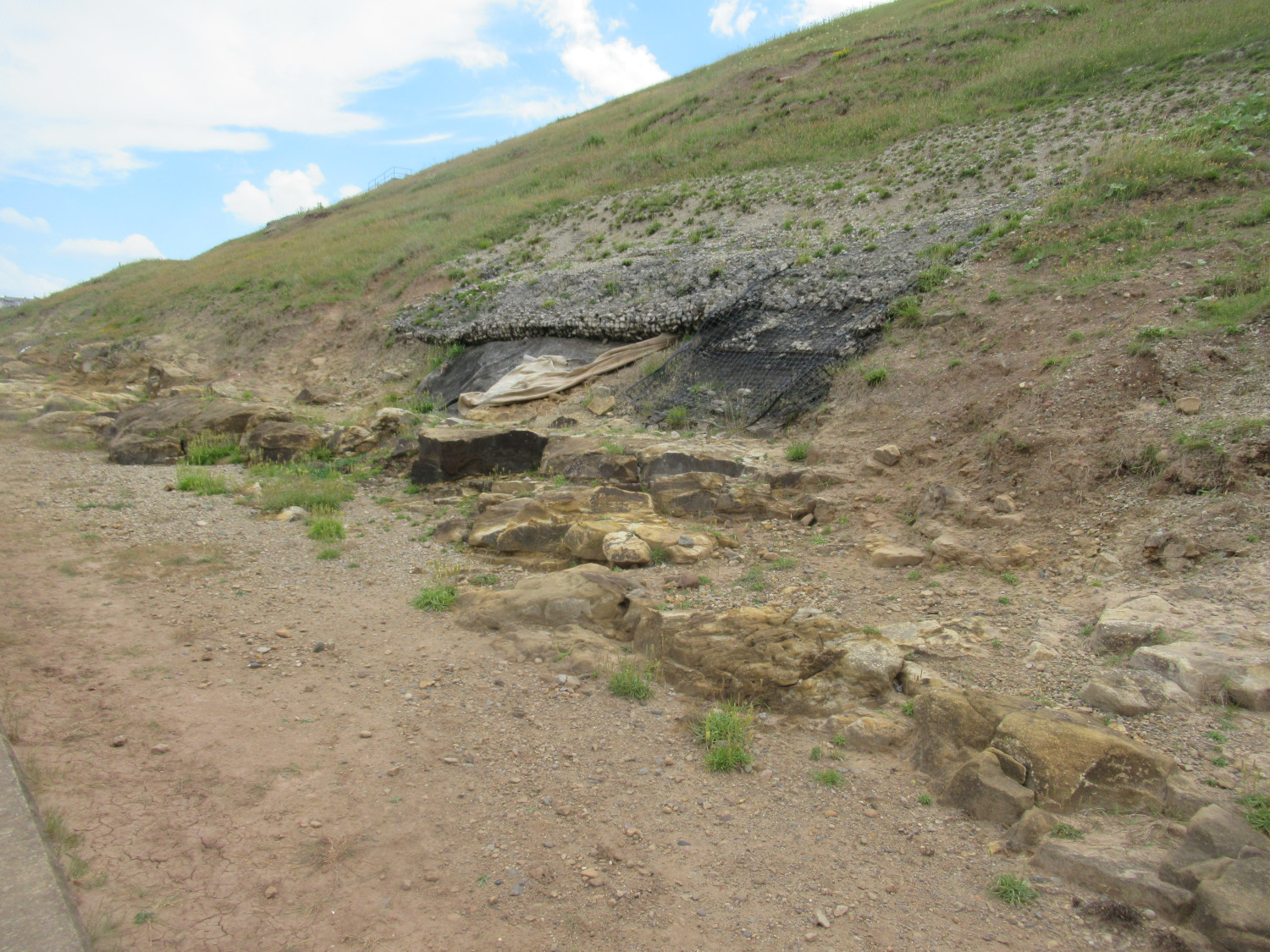
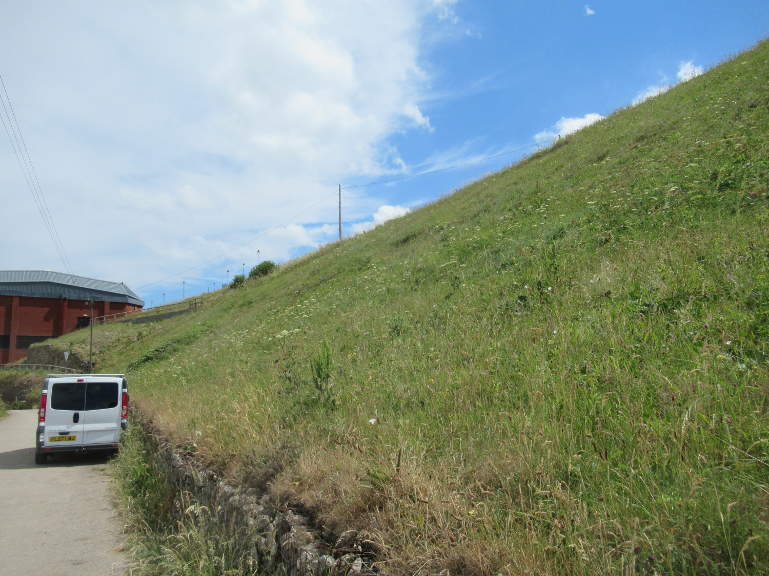
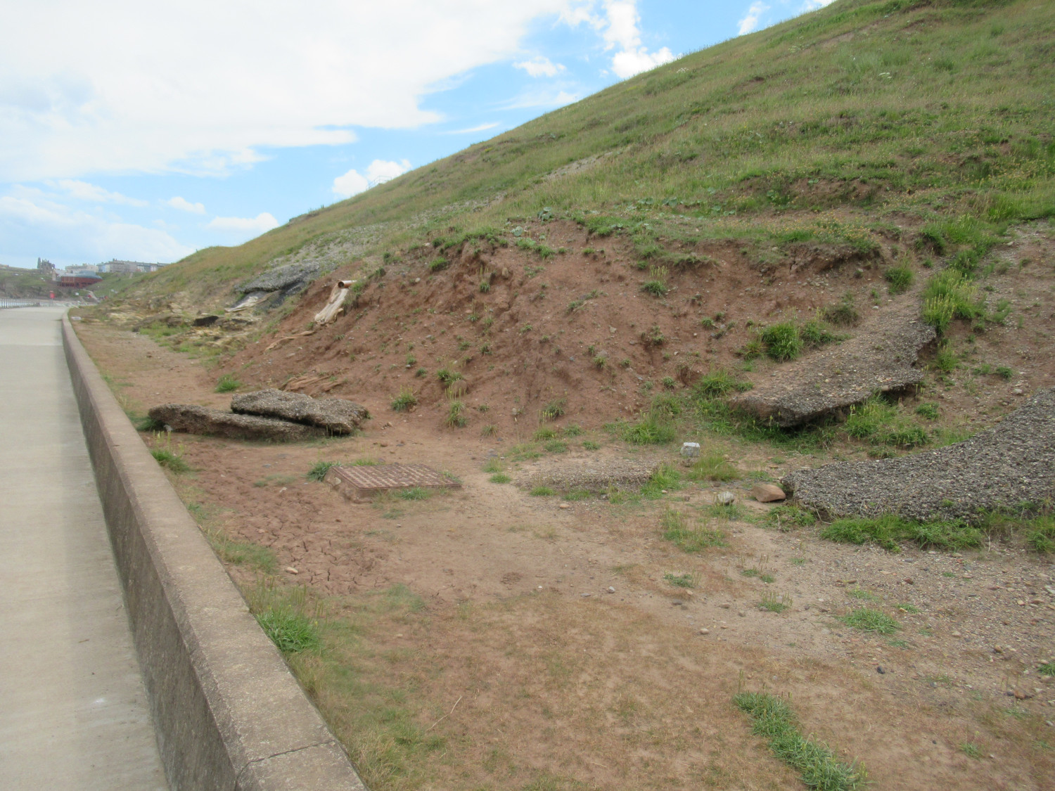
- West Cliff has a series of steep paths (30-45 degree gradients), and so only a subset of the space is accessible to only the very able-bodied, and inaccessible and non-inclusive to others. This is also the largest contributor to green space in the town, of which the majority is inaccessible. It has also suffered from landslips over recent years, as well as no weed clearance from paths. We consider it generous to take 50% as the accessibility+inclusivity.
- White Leys becomes a caravan park for several weeks of the year, hence unusable by residents during that period. We haven’t allowed for this unavailability in the calculation. Note, the same happens to Stakesby Primary and Caedmon College playing fields over summer holidays.
Whitby has
- [ignoring accessibility/inclusivity] a net deficit of 10.9ha : made up of a deficit of 12.6ha (5.4ha of Natural, 6.2ha of Urban Parks, 1.0ha of Sports) and a surplus of 1.7ha (1.7ha of Amenity). There is also a surplus of 5.6ha of green corridors (not included in calculations typically due to their role in connecting places, and not being usable to replace other types).
- [considering accessibility/inclusivity] a net deficit of 22.9ha : made up of a deficit of 24.6ha (10.9ha of Natural, 6.2ha of Urban Parks, and 7.5ha of Sports) and a surplus of 1.7ha (1.7ha of Amenity). There is also a surplus of 4.0ha of green corridors (not included in calculations typically due to their role in connecting places, and not being usable to replace other types).
Compared to Scarborough and Filey, where NYC is largely fulfilling its mandate, Whitby’s problems, highlighted in 2014, are not being addressed with the continual desire of NYC (and previously SBC) to reclassify green space for housing, ignore the findings of their own audit, and ignore condition HC14 of the Local Plan.
Other Measures of Green Space
There are several other measures of green / open space available, and here we present the results from two of the most prominent : Natural England’s “Green Infrastructure“, and Fields In Trusts’s “Green Space Index“. The message coming out of both of these tools is consistent with that from our own calculation method : the amount of green space provision in Whitby parish is below the minimum standard.
Natural England : Green Infrastructure
Natural England have developed a tool for assessing green infrastructure (GI) in urban areas, defining some measures for the level of green space provision. This can be found here. The current version (1.2) of this tool on the Whitby area reveals
- There are several areas in Whitby that fail the AGst Doorstep standard (0.5ha within 200m). Notably, large parts of Stakesby, Castle Park, Mayfield, Railway, Eskdale.
- The majority of the residential areas in Whitby fail the AGst Local standard (2.0ha within 300m).
- All of the Whitby urban area fails the AGst Neighbourhood standard (10.0ha within 1km).
The provision of green space is clearly unacceptable by Natural England’s proposed standards based on what data their tool currently has. It would be desirable if this GI tool was integrated with what SBC currently have (in terms of green space map areas, and types) so that it is simple to assess the different categories of green infrastructure. We have some areas of green space (SBC standard) that are not featured on the GI tool (e.g Rievaulx Road, Kirkham Close, Westbourne Road, some school playing fields, parts of Stakesby Vale, West Cliff top, etc). The problem seems to be that it currently uses OS Open Greenspace, and this is an incomplete representation of greenspace in the UK. Local authorities have the power to update the databases being used, so we need North Yorkshire Council to get on board this process, and accurately represent the green space of our District. Then we have an immediate assessment of GI in our area without having to resort to a manual audit every few years and having to fight every council attempt at re-assignment of green space land.
Fields In Trust : Green Space Index
A further measure of green space is provided by the Fields In Trust “Green Space Index”. Their system concludes that the majority of the Whitby area has “less than the minimum standard” (search for Whitby and zoom in) … this is largely consistent with the ANGst Doorstep standard above for the Natural England tool.
Quality and Maintenance
The 2014 Audit states a vision of “A well-managed, accessible semi-natural / native environment designated to protect and enhance wildlife / biodiversity. Includes water areas, appropriately sited information boards, bins, picnic areas and parking facilities. The area should be free of litter, fly tipping and dog fouling.”
The reality in 2022 is somewhat different, with this vision not being attained in many areas around the town.
West Cliff has had no maintenance for several years now, and has suffered some cliff slides. It’s quality rating should be downgraded to “Average” from “Good” (2014).
- Paths could be cleared of weed growth.
- Cliff slides need stabilising
- Cliff drainage, particularly near the sea wall, needs work.
In Vision for Whitby 2023, there were many comments about the need for a working Cliff Lift, and about the overall level of maintenance of the cliff area, including surface water behind the beach huts, and the need for better hospitality facilities around the promenade / sea wall.
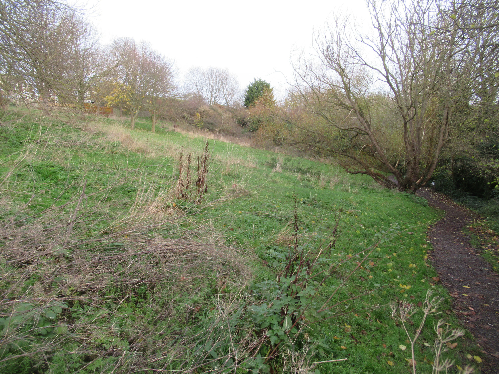
Stakesby Vale was rated as “Poor” in 2014, and has only suffered further deterioration since.
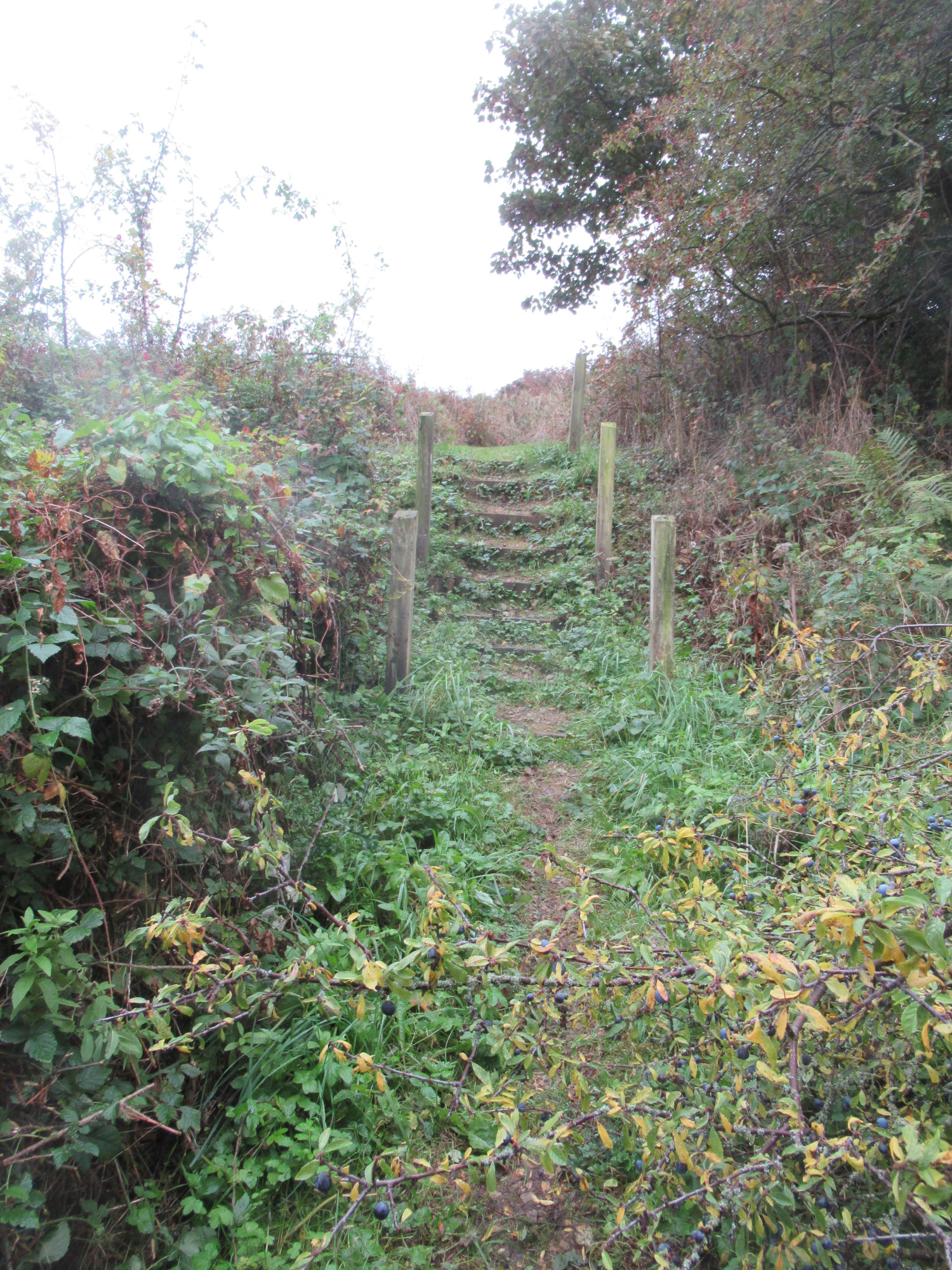
- Path : The beck path (NYC responsibility) currently consists of cracked concrete, small paves, and appalling patched tarmac. It does not support active travel, with a 1980s sign of cycling prohibited. It discriminates against disabled people, with a series of unnecessary steps just beyond Stakesby Vale gate.
- Maintenance : The area often suffers from fly tipping, and has areas that are totally overgrown, and undeveloped. The area where the scout hut used to be up to 1970s could be developed, for example.
- Lighting : It has street lamps from Stakesby Vale road through to the link between Sunningdale Grove and Dundas Gardens; these would need extending to High Stakesby Road for it to be a complete lit path route.
In the Vision for Whitby 2023 consultation, residents raised the many problems with this area, the need for a proper path that ideally caters for pedestrians, cyclists, and for disabled, as well as the need to add benches, communal areas, lighting, and maintain the play area.
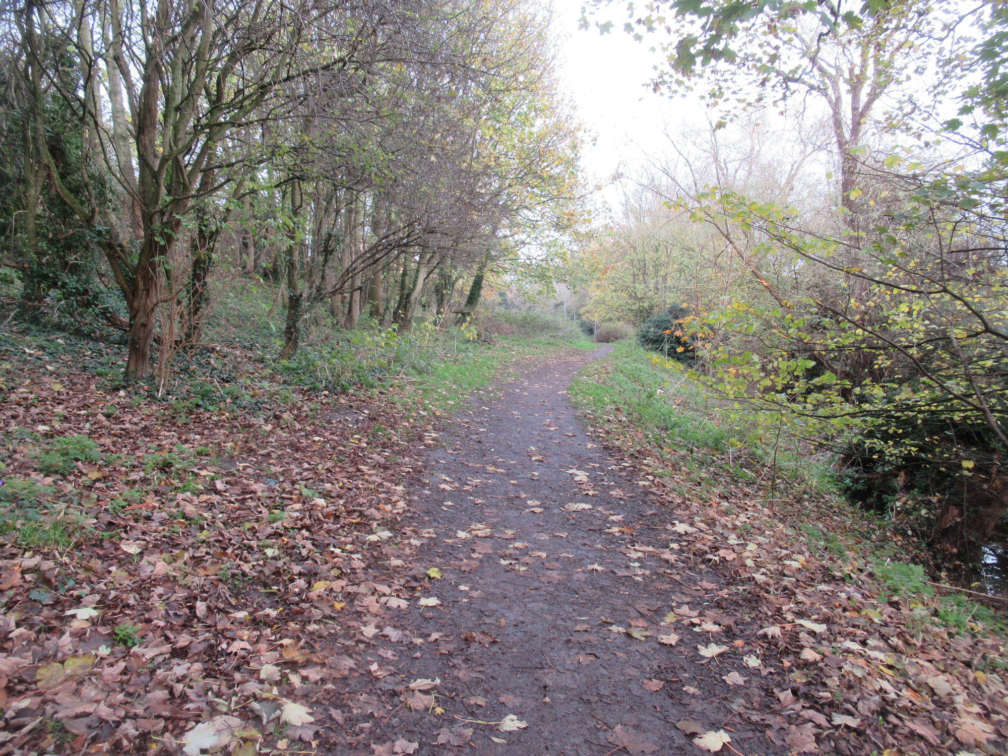
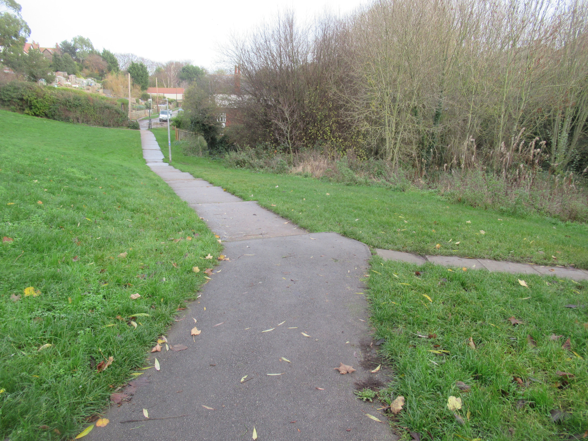
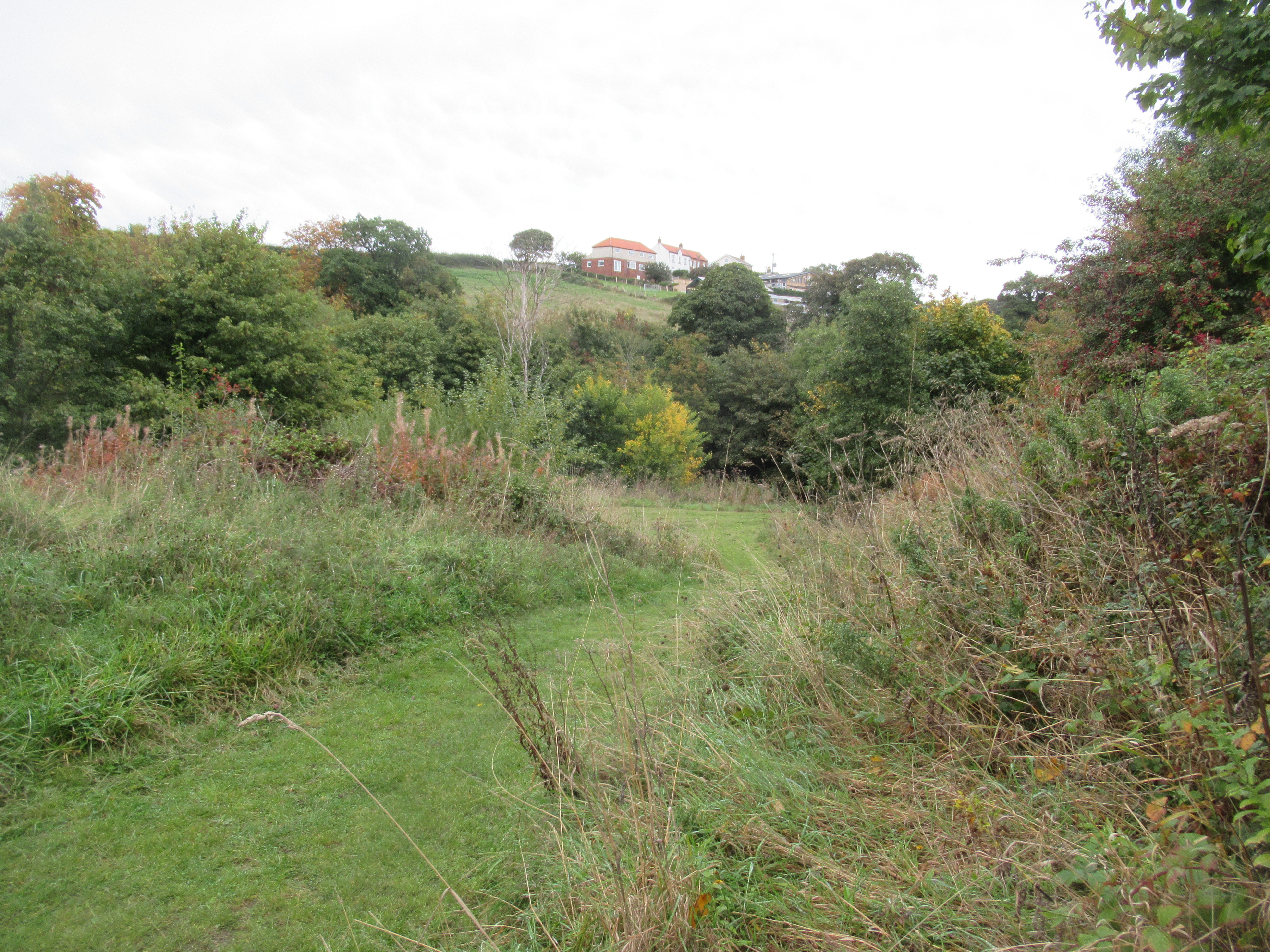
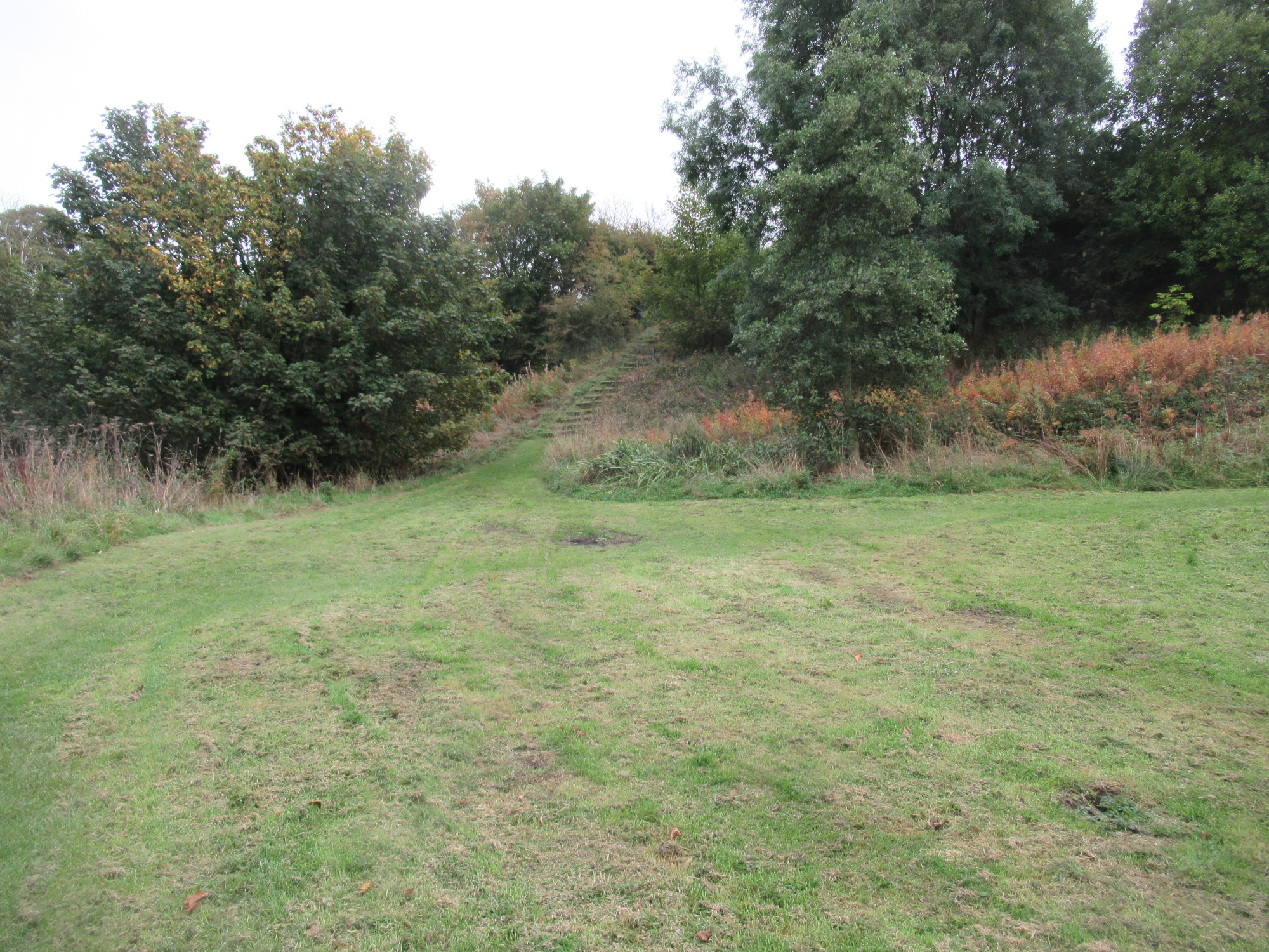
Upgang Lane Railway section was not rated for quality in 2014. It is a good sports amenity area, as well as for dog walking.
- It is totally overgrown the other side of Beeching Mews where the mesh fence has been put up.
- The fence needs removing to make it accessible. It needs a path running the full length, as well as benches.
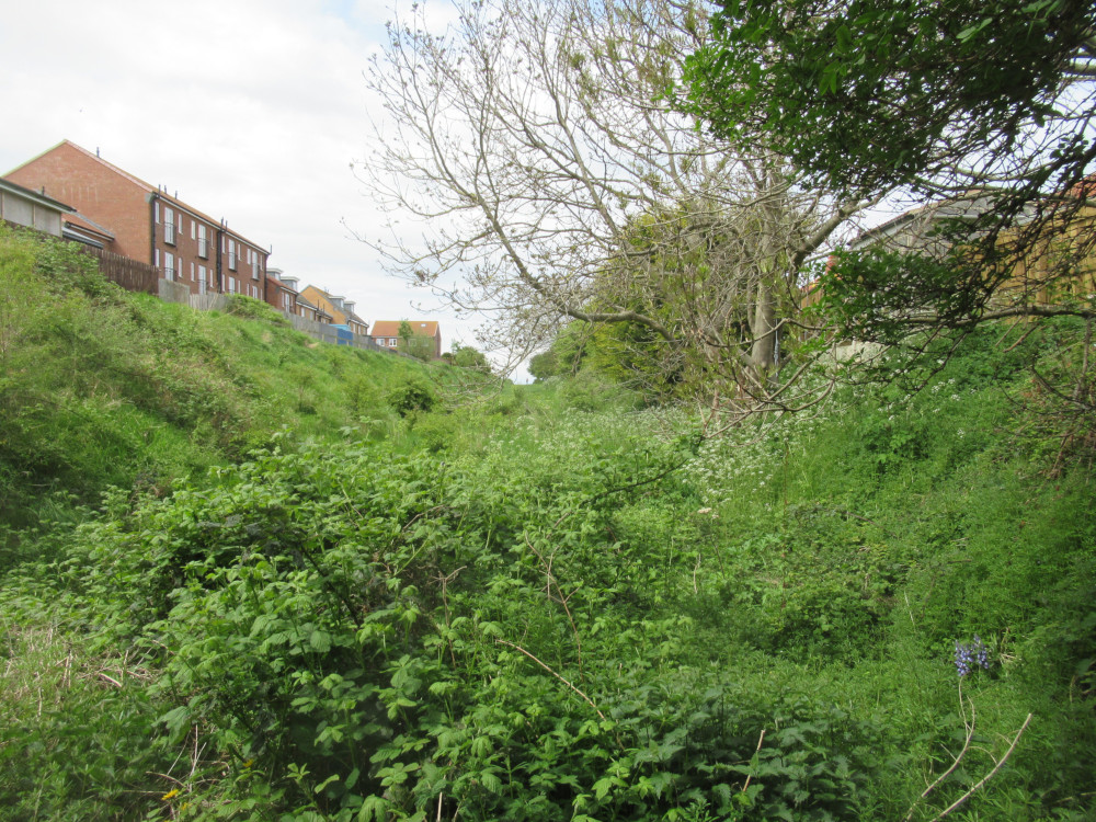
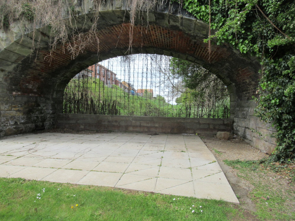
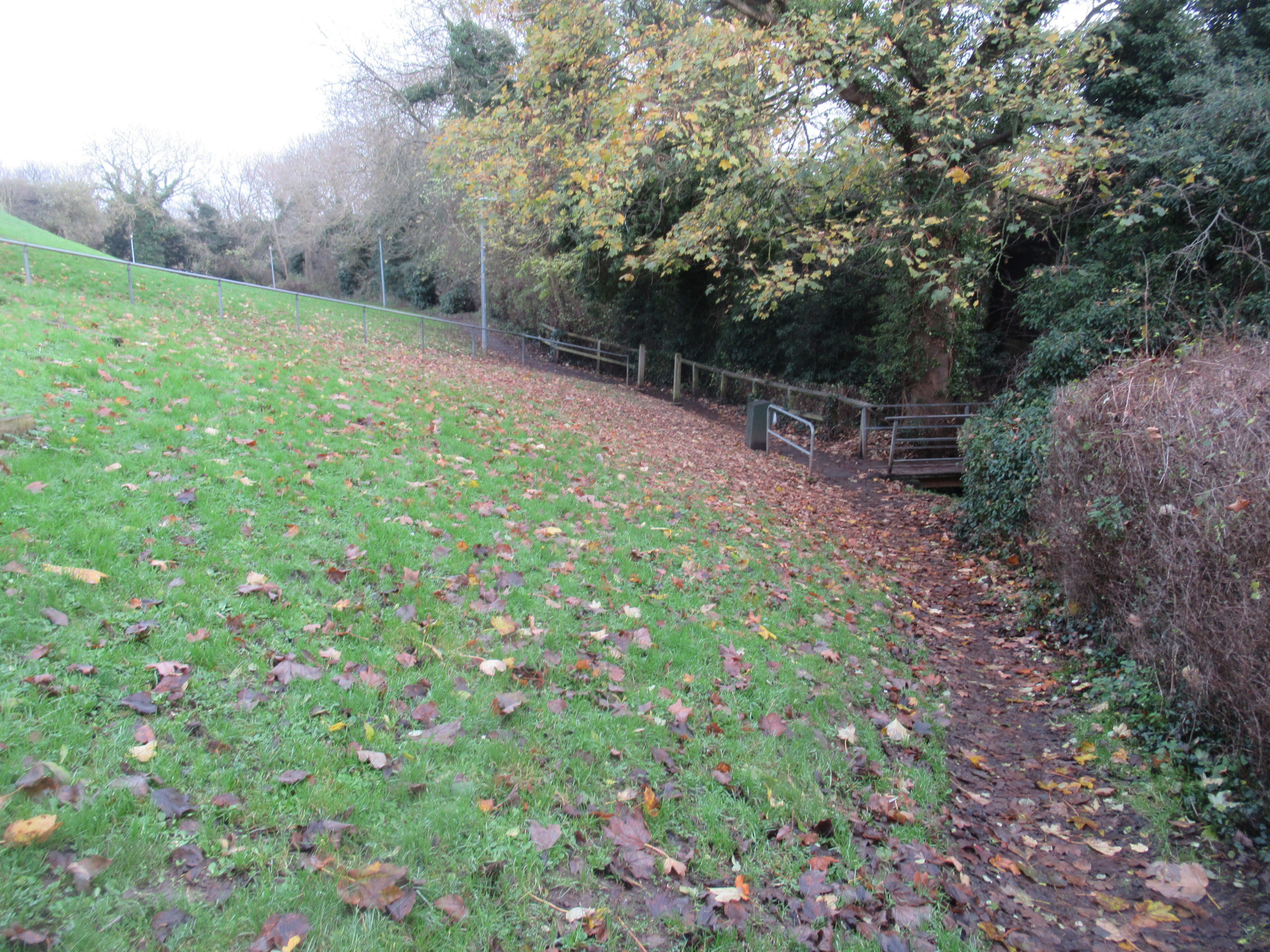
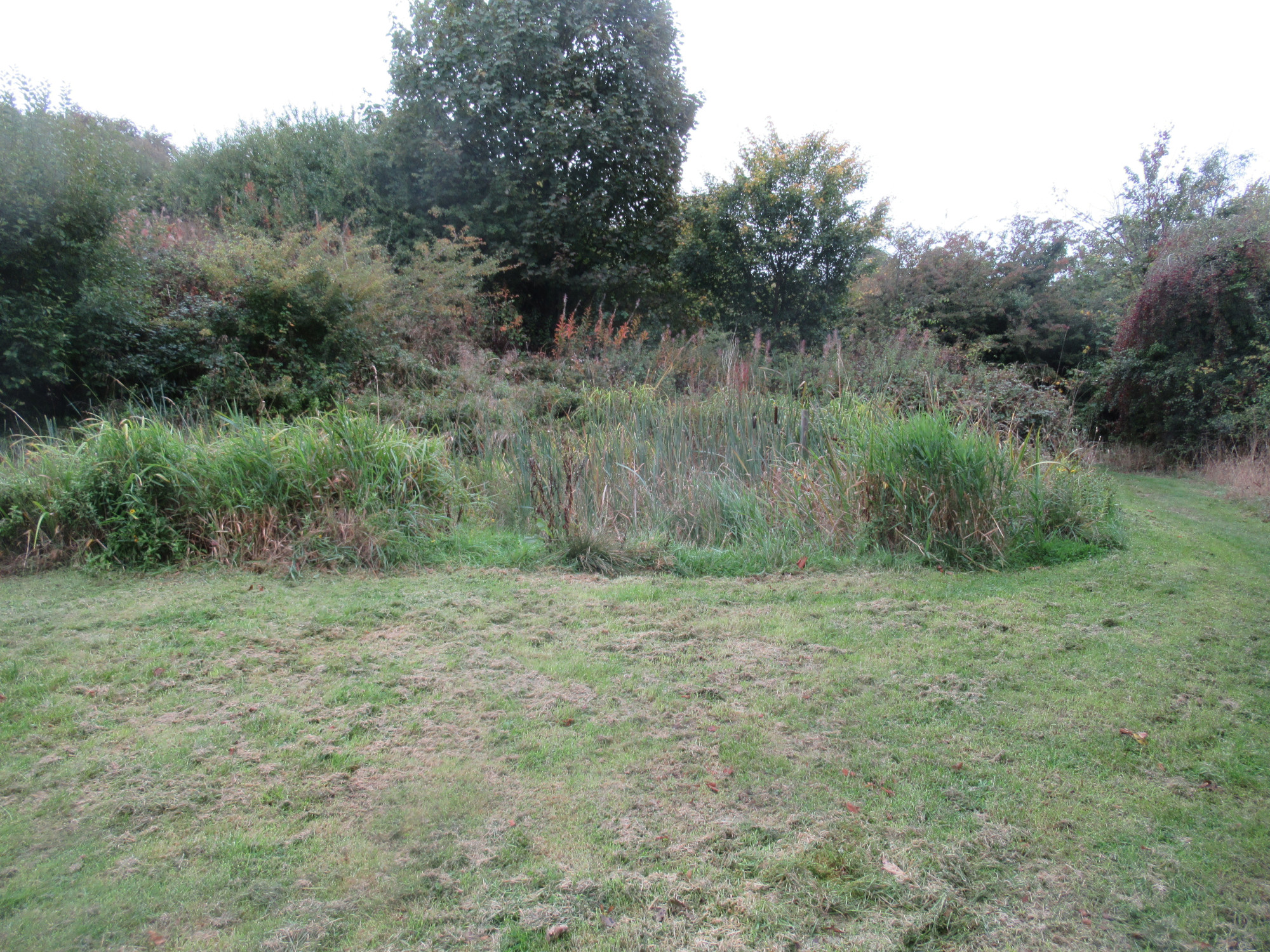
California Beck, or Calla Beck is not generally well-developed or maintained. It was rated as “Good” in 2014, but is arguably now “Average”.
- Utilisation : It currently has low utilisation partly due to the unappealing entrance.
- Maintenance : It would benefit from a general clear up around the entrance, adding an archway feature, for example, and a basic loop path (to improve accessibility), with benches. SBC made some minor updates recently (late 2022).
- The historical rubbish tip area is in need of development.
In the Vision for Whitby 2023 consultation, residents raised the problems of appeal, lack of disabled access, lack of reasons to remain in this area, and the need for a welcome sign, disabled access path, benches, and communal area.
Regarding the history of Tuckers Field, and any attempt to reclassify it from recreation (and why use of it as a car park is contrary to its stated purpose), this is from a news article reporting on Whitby Town Council from 14 Jan 2011 will be of relevance.
WHITBY Town Council is to write to Scarborough Borough Council (SBC) in a bid to halt any further development of Tucker’s Field. It is putting its objections on record in case there are any future plans to dispose of the green space and the adjacent car park.
The latest move comes after the town council noticed that when SBC registered Tucker’s Field on the electronic Land Registry database in 2007 details relating to it having special protection under the Public Health Acts were not also transferred.
At the full council meeting last week councillors debated the draft letter which had been put together. It stated: “Scarborough Borough Council is not in beneficial occupation of the land. SBC holds the land in trust on behalf of the ratepayers of the Parish of Whitby, who paid for its purchase. Whitby Town Council calls on Scarborough Borough Council to ensure the preservation of the remaining open land on Tucker’s Field for the recreation and enjoyment of the public, as originally intended when the land was purchased under the Public Health Acts and subsequently paid for by the rate-payers of the Parish of Whitby.”
The letter also states that Whitby has 44.3 square metres of parks and open space per head of population compared to 87.1 square metres in Scarborough. The town council’s research also shows that of the 16.8 hectares of “amenity green space” in Whitby almost half is Tucker’s Field and the rest is made up of the rugby club field, Green Lane recreation field which has been partially re-developed and Helredale playing field.
When the Tucker’s Field area was purchased in 1927 by Whitby Urban District Council (WUDC) it was done in two parts and under the Public Health Acts 1875-1925 to provide recreational open space for use by Whitby residents and visitors.
It paid £1255 for three acres between Upgang Lane and Crescent Avenue and £9300, funded by a public works loan, for 16 acres between North Road and Argyle Road including a farm rented from the West Cliff estate by a Mr Tucker. The loan was repaid using the parish council tax but when local government was re-orgainsed in 1974 the ownership of the land passed to Scarborough Borough Council.
A bid in 2009 by Whitby Town Council to have the area classed as a village green failed because it was already earmarked as public land because of how it was purchased. At last Monday’s meeting Councillor Sue Boyce said: “When we made the application for town green status they said it was not eligible to be considered because in their opinion it was covered by the Public Health Acts. There are only four large portions of land left, most of which are technically under threat. What we are doing is put our objections on the table before they even start that process.”
In the Vision for Whitby 2023 consultation, there were a large number of comments about the need to prevent car parking on this area, to add benches, picnic areas, a play area, trees etc to make this the recreation area it has the potential to be.
Larpool playing field was rated as Poor in 2014. It has not improved since then, with only basic grass cutting by SBC/NYC.
Whitby’s existing cemetery on Helredale Road will be full within the next 2-3 years. An extension was sought, and SBC decided on using Larpool Playing Field as the “preferred site”. Residents were asked what they thought of using Larpool Playing Field, and the overwhelming majority rejected the idea. It would represent
- a further removal of 1.7ha of scarce green space, in a town which is well below (minimum) local standard. With no associated plan on restoring the green space of this town.
- 1000+ dwellings on the east side of town have no free-to-access playing field for kids to play ad-hoc sports, or for families to have picnics, or a valuable dog walking space.
- a cemetery being provided in a location with no public transport anywhere near (how do the elderly walk from Helredale Road all the way to Larpool Lane?), and with a very narrow access road (read dangerous) for those with cars. Apparently Arriva have said they can provide a bus service down to near Larpool Lane – this is especially interesting bearing in mind there are significant parts of Whitby urban area that have not had a bus service for years, yet magically it is possible to get a bus service to a location where SBC want to house a cemetery. Why is it that they could not provide a bus service to Castle Park area? or Green Lane? never mind villages?
The development site behind Love Lane, known as HA22, is what residents have long said would be a good location, access from Love Lane and Highfield Road, and on a bus route. Sadly, SBC had already earmarked that green space for housing, building houses of a type that do not fulfil the requirements of the town (and that has had no consultation with residents). This is partially covered in a news story from November 2022.
In the Vision for Whitby 2023 consultation, residents unanimously said that Larpool Playing Field should remain green space, and that the cemetery be placed elsewhere. Additionally it should have a path added to provide safe walking / cycling to connect to the Cinder Track
Play Areas
As can be seen from the play areas map below, there are some areas of Whitby that do not have a Locally Equipped Area of Play, namely West Cliff area, Green Lane (though they do have some facilities on the playing field), and, as of July 2023, the Stakesby Vale area (due to bulldozing of the existing play area by NYC). The majority are Local Equipped (350m range), with Neighbourhood Equipped (700m range) at Airy Hill, Green Lane, Eastside and Broomfield Farm (not yet active – May 2025), and a single Settlement Equipped (1000m range) in Pannett Park.
In terms of ownership, management etc for the various play parks, this table lists publically available information.
| Location | Type | Range | Land Owner | Lease? | Insured By | Maintenance Responsibility |
|---|---|---|---|---|---|---|
| Pannett Park | Settlement | 1000m | WTC | NYC until Oct 2037 | NYC | NYC |
| Airy Hill Play Park | Neighbourhood | 700m | NYC | Trustees of Airy Hill Play Park until Dec 2034 | NYC | NYC |
| Green Lane | Neighbourhood | 700m | NYC | NYC | NYC | |
| Eastside Centre | Neighbourhood | 700m | NYC | Eastside Community Centre Ltd until Sep 2044 | NYC | NYC |
| Shackleton Close | Local | 350m | Barratts? | NYC | NYC | |
| Byland Road | Local | 350m | NYC | NYC | NYC | |
| White Leys | Local | 350m | NYC | NYC | NYC | |
| Eskdale Play Area | Local | 350m | NYC | NYC | NYC | |
| Westbourne Road | Local | 350m | NYC | NYC | NYC | |
| Anchorage Way | Local | 350m | Barratts | Allerton Property Management | Allerton Property Management | |
| Sneaton Castle | Local | 350m | S Harrison | (management agent) | (management agent) | |
| Highfield Road | Local | 350m | Yorkshire County Homes | (management agent) | (management agent) | |
| Broomfield Farm | Neighbourhood | 700m | Barratts | (management agent) | (management agent) | |
| Nightingale Drive | Local (?) | 350m | David Wilson | (management agent) | (management agent) | |
| Dundas Gardens ? | Local (?) | 350m | NYC | ? | ? |
In accordance with our transparency policy, this table is downloadable in spreadsheet format.
Allotments
While they were not considered as green space by the SBC Audit, allotments are considered green space using some measures. We have marked the allotments in the Whitby area on the above map.
| Location | Ownership | Area (ha) | Number of Plots |
|---|---|---|---|
| Green Lane | Private | 3.3 | |
| Prospect Hill | Private | 2.8 | |
| Stakesby Vale | WTC | 0.7 | 27 |
| Abbey | Private | 0.4 | |
| Cholmley | WTC | 0.2 | 9 |
| Calla Beck | WTC | 0.2 | 9 |
| Total | 7.6 | 45 |
In accordance with our transparency policy, this table is downloadable in spreadsheet format.
Allotments amount to 7.6ha in total. The number of plots on the private sites is unknown; please update us with this information if you know it. It is worth noting that Stakesby Vale allotments were drone surveyed in 2019-2020, presumably with a view to potential housing.
Future Updates
Whitby lacks green space necessary for the well-being of its residents, being below local as well as national standards, and all efforts should be directed towards protecting the current space and expanding it to overcome this shortfall. This has a direct impact on residents health and the local council should be not only looking to remedy the deficit, but also to enhance it; the evidence for the benefit of green space is compelling. To put this in context, both Whitby West and Whitby South and East are amongst the worst in North Yorkshire for life expectancy. This large deficit in green space is very likely a contributory factor and must be corrected.
Some green space is likely to be added to the above calculations in the coming year(s). Note that there have been no discussions with residents groups about the make up of this added green space, which goes against the WHO report conclusions. These green space areas (likely) to be added are marked on the above map, in colour turquoise. The calculation above will need revisiting at that point.
- ProspectHill Line : development of this former railway track bed from the CinderTrack to town centre would also contribute a “Green Corridor” (and is part of the Whitby LCWIP). A very rough calculation would be around 1.3ha. This is clearly dependent on development of this active travel route, the land being owned by Network Rail for most of the route. Should the space up the bank to Caedmon College be included allowing for more paths like in our Country Park proposal, then the area could be greater.
- Broomfield Estate : In the indicative estimates this development should have provided around 8.8ha of green space. The reality is more like 3.23ha of urban park and 0.42ha of amenity (whilst the indicative number of dwellings was 320, and the reality is around 520). This is a prime example of how residents are losing out to developers.
- Broomfield Estate Phase 1 (Barratts/David Wilson Homes) will be contributing an amount of green space alongside the Yorkshire Water treatment works. A very rough calculation from the initial development plan would be around 2.3ha (excluding the “attenuation basins” since they are unusable dead spaces for residents) as a “Neighbourhood Park”. Bearing in mind this area is immediately adjacent to the water treatment works, the aroma is unlikely to encourage people to spend much time there, so the quality of this space is undefined at this point.
- Broomfield Estate Phase 2 (Stonebridge Homes) is proposing to provide around 0.93ha of urban park, 0.42ha of amenity space, together with a play park of 0.15ha (total 1.5ha).
- Broomfield Estate Phase 3 (Brierley Homes) is not proposing to add any green space.
Whilst addition of green space is positive, one is simply a “Green Corridor” item that doesn’t address the problems. The Broomfields Farm areas will be classified as “Neighbourhood Park” in the Phase 1 planning, so we assume in the same category as Urban Park.
If we analyse the progress since the 2014 Audit, on the plus side the Broomfields Farm development is providing the order of 3.6ha green space, and on the minus side we have lost Helredale playing field (1.6ha), Highfield Road (1.1ha), Eastside (0.25ha) and the following are under threat of reassignment : Larpool playing field (1.7ha), Rievaulx Road (0.6ha) … in total 5.25ha. This makes a net loss of around 1.65ha over maybe 12 years (by the time Broomfield Estate is fully developed), whilst Whitby has a deficit of around 12ha against the local standard (before we look at accessibility). Should progress continue at the same rate Whitby would never achieve the “local (minimum) standard”, and consequently we consider this unacceptable. The Whitby Neighbourhood Plan may impact on this once adopted – watch this space.
You can view our proposals for green space on this page.
Planning Protection
The current (2011-2032) Local Plan states the following about open space
Policy HC 14
Open Space and Sports Facilities
a. The creation of high quality open spaces and sports facilities and the improvement of existing open spaces and facilities for sport and recreation will be supported by
- allowing for the development of new or improved sites where it would not detract from the character and appearance of the surrounding area, including the character of the landscape, where appropriate;
- and requiring developers to make provision for open space through development, in line with the Borough Council’s adopted standards.
b. The redevelopment of existing open spaces and outdoor sports facilities, including those identified within the Green Space Audit and Playing Pitch Strategy or any subsequent updates, for non-open space uses will only be permitted where
- the existing open space does not contribute positively to the character and appearance of the area; and,
- there is an identified surplus of that type of open space or sports provision in that locality and the site cannot be reclassified to meet an identified deficit in another form of open space or sports provision; or,
- a replacement open space of an equal or higher quantity and quality can be provided in a nearby accessible location.
Since there is no surplus of any type of green space other than “Other – Amenity” (which could be reclassified to meet an identified deficit) this means that no green space should ever be reclassified for development (non-greenspace usage) if planners are obeying the Local Plan.
Clearly (SBC) planning ignored this when reassigning Highfield Road for development, and ignored it again when reassigning Helredale Playing Field. Will NYC be any different?
Should their own Local Plan not be adequate to convince, try the National Planning Policy Framework (NPPF) which states
103. Access to a network of high quality open spaces and opportunities for sport and physical activity is important for the health and well-being of communities, and can deliver wider benefits for nature and support efforts to address climate change. Planning policies should be based on robust and up-to-date assessments of the need for open space, sport and recreation facilities (including quantitative or qualitative deficits or surpluses) and opportunities for new provision. Information gained from the assessments should be used to determine what open space, sport and recreational provision is needed, which plans should then seek to accommodate.
104. Existing open space, sports and recreational buildings and land, including playing fields and formal play spaces, should not be built on unless:
(a) an assessment has been undertaken which has clearly shown the open space, buildings or land to be surplus to requirements; or
(b) the loss resulting from the proposed development would be replaced by equivalent or better provision in terms of quantity and quality in a suitable location; or
(c) the development is for alternative sports and recreational provision, the benefits of which clearly outweigh the loss of the current or former use.
Given that the most recent “assessment” was the 2014 SBC Green Space Audit, then NYC should have no possibility of changing the classification of any Whitby parish green space.