In the Vision for Whitby 2023 consultation, residents registered many problems with the current car parking situation and the need for a car parking review promised back in 2018. This review has to provide ample parking for residents first and foremost, and to aim to move much more visitor parking out of the town centre.
Road Transport
The health and well-being of Whitby and District residents is dependent on being able to get about their town/villages safely, and with minimal delay. The Scarborough Borough Council Transport Assessments SPD document (2007) states as one of its sustainability objectives “To provide a transport network which encourages the use of public transport, cycling and walking and minimises traffic congestion“. A rural county like North Yorkshire can have a dependency on use of a car for transport. The road network needs to work for vehicles, cyclists, and pedestrians. The road network around Whitby has several locations that are inefficient, and also are not as safe as they could be.
A useful background document analysing the traffic in the Whitby area, particularly looking at visitor traffic is a study by the Whitby Beacon Town Forum in 2006, which you can find HERE. This highlighted that, amongst other things, 85% of the vehicle INFLUX into Whitby comes down Guisborough Road (from the A171 Teesside and A169 Pickering). This was the defining factor why the current Park-and-Ride was built at the west side of Whitby.
Car Parking
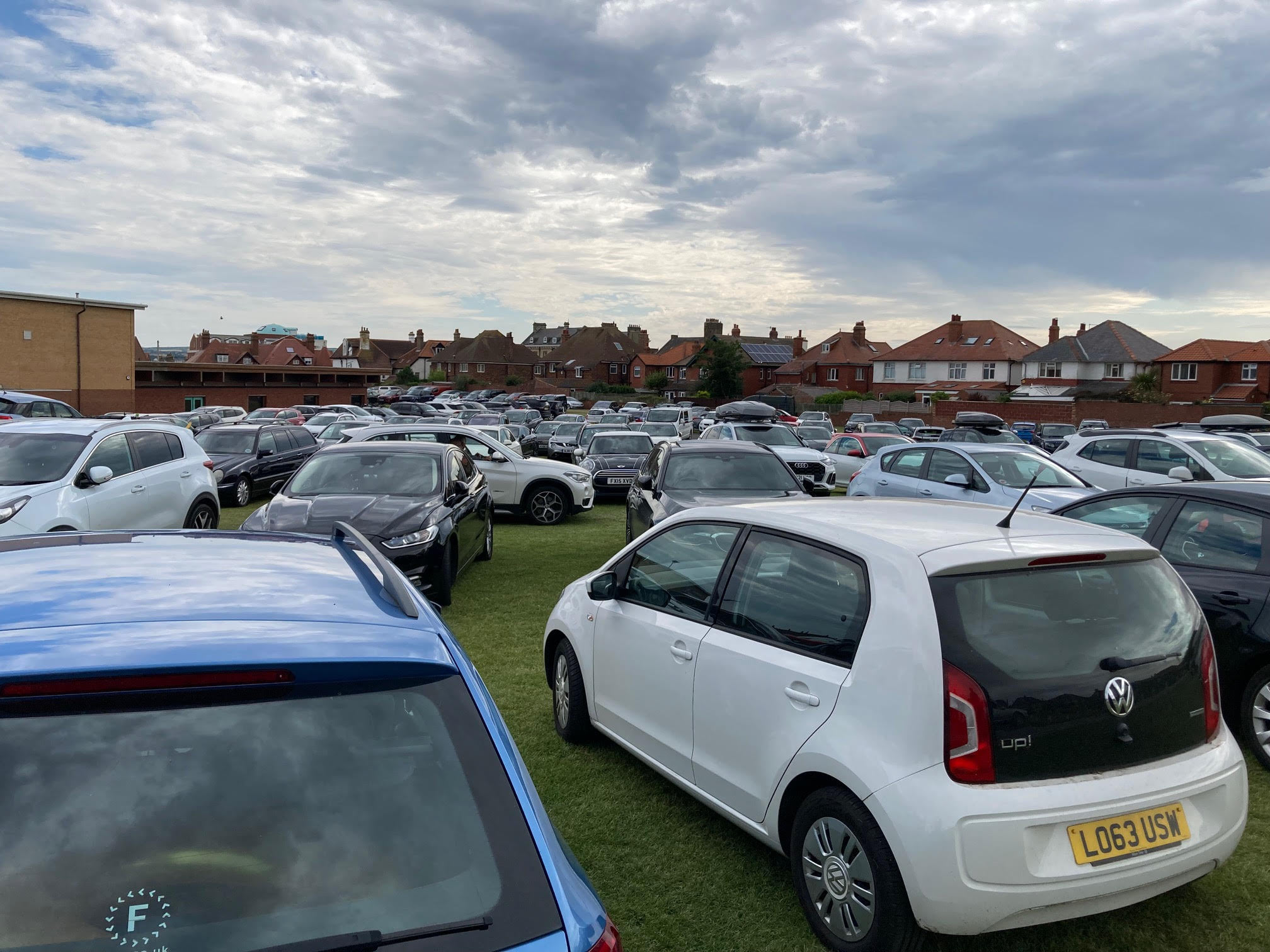
Whilst those less able-bodied will often need to come into town by private vehicle (in the absence of a decent local bus service), the town should have a policy of aiming to reduce car parking, and give road space across to the pedestrian / cyclist, and to public transport. As part of this strategy of reducing car parking, the council policy of re-purposing of green space to be overflow car parking has to stop. The sheer numbers of tourists in Whitby in busy periods has to be controlled, and restricting use of overspill car parking is one method that could be effective, perhaps with “all car parks full” signage visible when coming in to Whitby.
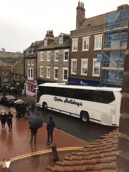
There have been numerous instances of coaches taking a wrong turn and getting stuck on tight streets (e.g Fishburn Park area), or due to on-street parking. Signage has to be improved, and restrictions put in place to severely restrict the places that coaches can navigate.
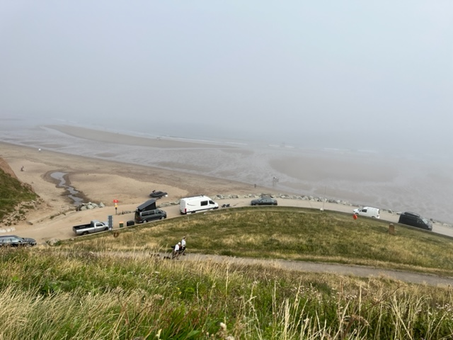
During summer months there are very often lines of campervans parked on the Ravine and Sandsend Road overnight. This is contrary to the signage, and was not enforced by SBC. We need a clear policy, and associated enforcement. Providing more camping sites should be investigated if they are currently near capacity. Investigate use of new laws, like those introduced in New Zealand, about restricting “freedom camping”.
The current car park facilities are defined in this table.
| Location | Stay? | Total Spaces | Number Disabled | Number Coaches | Notes |
|---|---|---|---|---|---|
| Abbey Headland | Long | 431 | 6 | 10 | |
| Church Street | Long | 95 | 3 | 0 | |
| Cliff Street | Short | 37 | 0 | 0 | |
| Endeavour Wharf | Long | 250 | 0 | 0 | 52 to be lost for Maritime Training Hub (all 250 lost between Apr 2025 and May 2026) |
| Marina Back | Long | 358 | 0 | 8 | |
| Marina Front | Short | 96 | 2 | 0 | |
| Marina Harbour Users | Long | 79 | 0 | 0 | |
| St Hilda’s Terrace | Long | 20 | 0 | 0 | |
| Pavilion Drive | Long | 68 | 2 | 0 | |
| Pavilion Top | Long | 63 | 0 | 0 | |
| West Cliff | Long | 439 | 4 | 11 | Includes ~200 spaces on overflow green space |
| Whitby Railway Station | Long | 48 | 0 | 0 | Not NYC |
| Sub-Total (Town Centre) | 1984 | 17 | 29 | ||
| Park-and-Ride (West) | Long | 450 | 0 | 0 | |
| Sub-Total (Out Of Town) | 450 | 0 | 0 | ||
| Total | 2434 | 17 | 29 |
In accordance with our transparency policy, this table is downloadable in spreadsheet format.
As seen, even when we consider just dedicated car parks (and ignore on-street parking) the out of town park-and-ride facility is very small relative to the amount of parking required, and is doing little to remove vehicles from the town centre area. Traffic will not be reduced in Whitby until the out of town facilities are much increased, or longer distance public transport facilities are overhauled.
Park-And-Ride
The sole Park-and-Ride facility on Guisborough Road is largely ineffective at reducing the amount of traffic in town centre, or of reducing the demand for town centre parking (it only provides 20% of the total town car parking). Expanding the current site could be an option (subject to national park approval), otherwise a further facility is required, likely on the east side of the town, and the best location for this would probably be towards the Abbey Headland, to take traffic coming from the Scarborough direction. Having data about level of utilisation of the current facility would be a start, but NYC do not keep any meaningful data (from an FOI request)!
The current (SBC) Local Plan (9.12) suggests “provision of cycle facilities at park-and-ride sites” to provide a “modal shift” in transport. NYC (under the NYCC name) obtained funding for just such a scheme in Active Travel Fund (Tranche 2) and then subsequently realised it would only provide a cycle route down Guisborough Road, and then leave its users at the mercy of the traffic due to the absence of any cycle network in Whitby. The Local Plan suggestion would only be of any value should there first be an active travel network that would reach the centre of Whitby, which there is currently not. That “suggestion” should subsequently be deprioritised until a cycle network is in place.
In the Vision for Whitby 2023 consultation, residents expressed a clear desire for expanded Park-and-Ride services, on both sides of Whitby and for the general moving of tourist traffic out of town.
Pavement Parking
We support any campaign to prohibit pavement parking, such as this one from Living Streets. We want Whitby and District to be pedestrian friendly. Vehicles should always be parked in appropriate places, and sufficient parking should be provided with such as holiday lets for pavement parking to not happen. The current law (2023) states
Is parking a motor vehicle on a pavement legal?
No, it is illegal except
- where signs permit it – local councils can permit parking on the pavement on specified roads via signs on posts and white lines on the pavement
- in an emergency
- if the vehicle (e.g. a motorbike) is pushed on to the pavement rather than driven on, provided that it does not obstruct pedestrians.
What are the laws that prohibit parking on pavements?
- It is an offence to drive on to a pavement (the Highway Act 1835 and Road Traffic Act 1988 – see the Highway Code section 244).
- It is an offence to obstruct a pavement – via Regulation 103 of The Road Vehicles (Construction and Use) Regulations 1986. The definition of obstruction is not spelt out, but many vulnerable people need a pavement width of 2 metres, e.g. someone needing a guide dog, or in a wheelchair, or groups of parents with buggies.
Remember though that this is currently a criminal matter, and so can only be enforced by North Yorkshire Police. It would have to become a civil matter for North Yorkshire Council to be able to enforce it.
Sea Wall / Promenade / Ravine Parking
The response from NYC regarding vehicular access and parking in this area is as follows
“There are no current restrictions in place to enforce against vehicles accessing the area and parking that Council staff can undertake.
However a meeting between highways, beach management, parking enforcement staff and Whitby Councillors took place in June 2023 to consider this ongoing problem. Discussions resulted in the option to pursue an on street traffic regulation order (TRO) to designate the area as a pedestrian zone was the preferred option to take forward. A barrier or bollards were considered, however we have to maintain access for emergency vehicles and legitimate users of the area. Also experience of barriers in other locations have resulted in the abuse (ie keys copied and circulated to all others, damage to barrier to gain access, barriers left open etc.
Now as you may know the process to implement a TRO is a lengthy process which includes initial design work, going through the democratic process, advertising the proposals for public consultation, then if approved installing signage etc on site.
Unfortunately this will not be implemented ready for the summer season as this can take in excess of 6 months.”
Road Safety
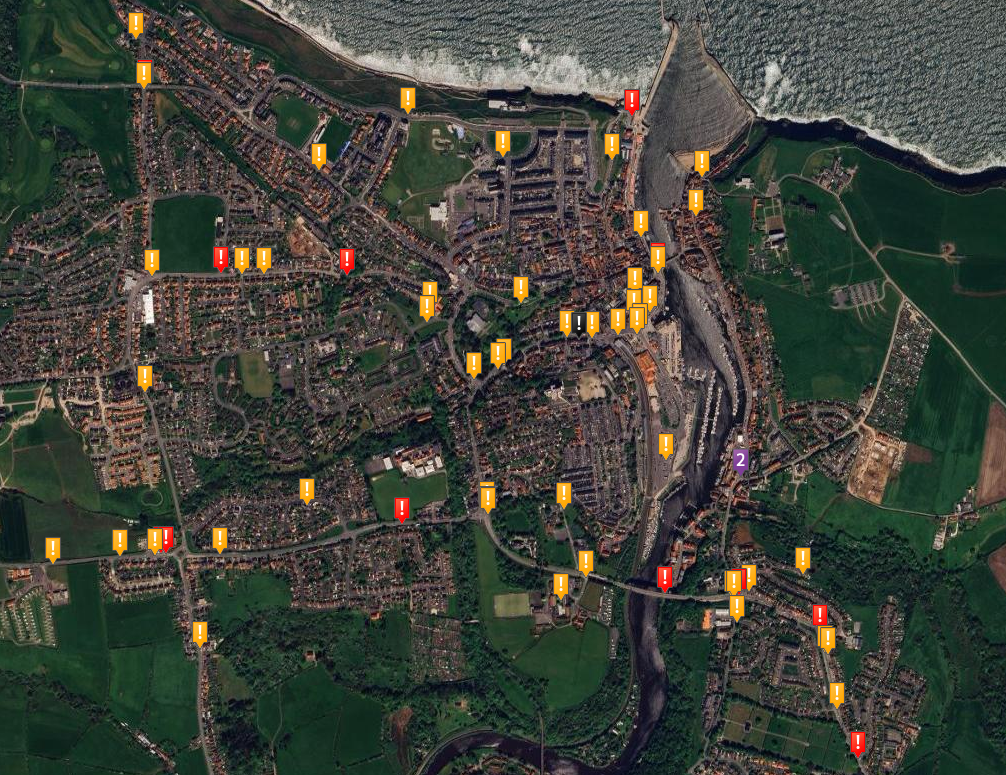
This image displays the road collision data of reported collisions between 2018 and 2022 on Whitby roads. There are some clear hotspots, suggesting issues with road speed and / or road design. An interactive version of this map is available HERE (enter “Whitby, United Kingdom” to get the below map). On this map black signifies FATAL, red signifies SERIOUS, and amber signifies SLIGHT. For reference a fatality costs the UK economy the order of £1.7m, whereas a serious casualty costs around £200k.
The following areas would benefit from an assessment and redesign to work better for the safety of Whitby and District residents.
- Mayfield Road (Whitby) – the problems with this road are many, and traffic backs up along its length for many months of the year.
- It has a 30mph limit that is frequently ignored, often by drivers of goods vehicles; as evidenced by the vehicle-activated sign (VAS) that will be triggered every 5 minutes, but sadly this does not store data, being purely a “please slow down, but we can’t be bothered to enforce here”.
- The 4-lane-ends roundabout is problematic for pedestrians crossing, with fast moving traffic coming in to Whitby, and having to find a gap in the traffic, despite the highway code giving priority to pedestrians. Traffic calming measures, and priority for pedestrians would be appropriate. It should also integrate with the proposed cycle path running alongside Stakesby Road, and the other proposed path along Stakesby Vale beck path.
- It has no pedestrian crossing between 4-lane ends and the Prospect Hill junction … half a mile (and the crossing at Prospect Hill junction is so slow to change that it disadvantages pedestrians).
- The Prospect Hill junction where we have the sole pedestrian crossing on the whole road. Current Highway Code prioritisation of users has pedestrians at the top, and this is the opposite of what the current junction provides for. It takes maybe 2 minutes for the (pedestrian) lights to change to let people get across!!! The bottleneck in vehicle traffic on Mayfield Road is the traffic light set up at the junction with Prospect
Hill and the new bridge (queuing down Mayfield Road in the morning, and queuing up Down Dinner Hill in the afternoons). This junction needs redesigning firstly to prioritise pedestrians, and secondly to be efficient for vehicles. So think of, you know, a roundabout, with pedestrians crossings. - The junctions with St Andrews Road, Pembroke Way and Mayfield Place are notoriously difficult to get out of at busy times; they need redesigning. For the Pembroke Way case when vehicles park on Mayfield Road before the Mayfield Place turn off it makes visibility of oncoming traffic from 4-land ends impossible. For the Mayfield Place case you cannot see traffic along Mayfield road due to a low exit and parked cars.
- The associated proposal on this site for a cycle network needs access on to the old farm track (so as to connect to the currently disused bridge over the CinderTrack) and this would need integrating into any redesign.
- Outside Whitby School (Prospect Hill Site) buses park and offload/load pupils, blocking the traffic; this should be redesigned (to have the bus stop indented and restricted to bus usage only, alternatively provide a better school entry point that buses can enter in to and turn) in conjunction with access to the proposed cycle connection.
- Spital Bridge (Whitby) – The junction of the A171 (Whitby New Bridge) and Spital Bridge / Larpool Lane needs redesigning. It is having a redesign as part of the Town Deal “Bridge Pedestrianisation” after being flagged by many people; with traffic lights being added. For the record the problems are
- It is notoriously difficult to get out of side roads.
- It provides inefficient crossing facilities to ease the passage of pedestrians towards town centre.
- There is an associated proposal on this site for a cycle network, with one route running alongside the A171, up Helredale Road providing connectivity with the industrial area.
- Helredale Road (Whitby) – Traffic which is often very heavy, including lorries to/from the Woodsmith mine amongst other places, travelling past the entrances to 2 schools, often at speed.
- Very hard to get out of side roads … Abbotts Road, St Peters Road, Eskdale Road, etc.
- Dangerous traffic for the schools. East Whitby Primary has just provided the most significant vote of no confidence in the road system by issuing a letter to all parents saying that they will not let children leave the school unaccompanied to walk alongside that road!! If this is not an adequate message to enact change we really do not know what is.
- Will need to integrate with the output of the Local Cycling Walking Infra Plan when available.
- Green Lane (Whitby) – likely needs double yellow lines for significant stretches, particularly near the top. Plus a crossing.
- Love Lane (Whitby) – Another problem area.
- The junction of Love Lane / White Bridge Road and Sandsend Road often has accidents or near misses with traffic coming from Sandsend on a 60mph road not slowing adequately. Current Highway Code prioritisation of users has pedestrians at the top, and this is the opposite of what the current design provides for. This needs redesigning, probably with traffic lights and associated pedestrian crossings.
- Need to integrate the associated proposal on this site for a cycle network, extending the Cinder Track to this junction and down Sandsend Road.
- It should be considered to reduce the speed limit on Sandsend Road, it has a couple of corners where it is common to encounter vehicles on the wrong side of the road. Dropping the limit to say 40mph would be beneficial for safety.
- Larpool Lane/Glen Esk Road – Narrow road, with “danger bank” often with vehicles travelling way too fast for the conditions. Should be 20mph, with suitable measures to minimise the risk to pedestrians and cyclists. Traffic using this road through must be reduced since passing space on Larpool Lane closer to New Bridge is very limited also.
- Ruswarp – Traffic coming down Ruswarp bank is often not prepared for the 20mph zone, and measures should be implemented to reinforce this zone.
- Ravine – It is very common to see vehicles down on the sea wall, daytime, or nightime. Vehicular access to the sea wall itself should be restricted, by use of lockable bollards. Camping on the ravine is also quite common, and this area should also have some form of restriction.
- Swing Bridge (Whitby) – The east west connecting bridge often breaks down, leaving people stranded on one side or the other, sometimes for hours.
- Hawsker Lane – Should be reduced to 40mph limit, with 30mph in places. In Hawsker itself (definitely outside the school) 20mph would be appropriate.
The list as it was at the start of September 2023 was sent to NYC Area 3 Highways, and the reply received is documented on this news post. To paraphrase the reply, NYC have little funds for such improvements, they do not see making a town more pedestrian friendly as a priority, and there would need to be more killed and seriously injured to gain any priority.
In the Vision for Whitby 2023 consultation, residents raised significant concerns about the A171 route through Whitby (many dangerous junctions, difficulty in getting out of side roads, speed issues particularly around schools and New Bridge), Love Lane junctions, The Carrs, and Sandsend Road.
20mph Zones
We have a proposal to make residential and central zones in Whitby (and potentially all villages) as 20mph. This would make a massive difference in terms of the safety of pedestrians and cyclists (shown on the above road collisions map), and the quality of life for residents, being able to get about by walking, and would make cycling a possibility for many residents and visitors alike.