Green Space Proposal
Everything in this concern comes under the NYC Portfolio including parks, Cllr Keane Duncan.
As we have seen in our analysis of Whitby Parish green space, there is a significant deficit of natural, urban park and sports green space and, additionally, some areas of green space have not been adequately maintained for many years.
Our plan, in short, is to
- halt the decline of green space, removing the causes of decline
- work to eliminate the deficit in quantity relative to the local standard,
- improve the quality of the areas that are rated Average or Poor.
- improve the overall biodiversity of the available green spaces
This is defined by a 10-point plan, below.
- Oppose all reallocation of Green Space for any type of development
- Manage Green Space locally
- Prohibit Car Parking on Green Space
- Develop Calla Beck to improve the quality and biodiversity
- Develop Stakesby Vale to improve the quality and biodiversity
- Provide more free-to-access public sports areas
- Develop a Country Park around the Viaduct (Natural/Sports Green Space) in memory of Queen Elizabeth II
- Develop Urban Parks in East and West side residential areas
- Develop Ruswarp Fields into a Wetland (Natural Green Space)
- Develop a Waterfront Urban Park
What do you think of these outline proposals? Please let us know, via the Contact Us form.
1. Oppose all reallocation of Green Space for any type of development
Until Whitby achieves the local/national standards, the only way current green space should be allowed to be reclassified should be by first classifying some other (at least equivalent) land as green space to halt the decline. Note that this is already in the existing SBC Local Plan (HC14)
“The redevelopment of existing open spaces and outdoor sports facilities, including those identified within the Green Space Audit […] for non-open space uses will only be permitted where […] there is an identified surplus of that type of open space or sports provision in that locality and the site cannot be reclassified to meet an identified deficit in another form of open space or sports provision; or, a replacement open space of an equal or higher quantity and quality can be provided in a nearby accessible location.”
Just that SBC are seemingly not applying it at the planning stage (or bypassing the planning stage by selling it off first). Developments such as “Better Homes” and the Cemetery Extension using Larpool Playing Field land should be opposed strongly.
Only in the case that whichever council provide an actual plan (with funding and implementation timescales) that defines how green space will be reinstated should we consider not opposing removal of any current green space.
This should be performed via a Neighbourhood Plan – see this reference for how to designate local green spaces in the Neighbourhood Plan.
2. Manage Green Space Locally
Green space is integral to the well-being of residents and should be managed locally, by people who care about the town. With the advent of North Yorkshire (unitary) Council, and the wish to devolve powers to local town/parish councils, we think it would be best if Whitby Town Council (WTC) together with local community groups ultimately managed (the majority of) Whitby green space. Having such areas managed by a distant council like SBC certainly has not worked, and NYC have no experience managing green space. That way we at least have the prospect of having an organisation in charge of maintaining it that will do all that it can, and not just leave it to decay like has happened under SBC.
This change of management will require an amount of experience building within WTC (over many years probably, together with obtaining land and facilities) but, if coupled with other devolved assets such as the beach huts, could provide far more responsive local control than is possible currently. WTC being in control of green space would mean that they should develop relationships with community groups like Friends of Pannett Park, Whitby in Bloom, etc, Whitby Naturalists taking an active role (should they wish), as well as getting input from NYC Ecologists as appropriate. Management of green space would also need to establish a communication mechanism with residents (something that never happened under SBC – local control can be much better)
- for residents to provide suggestions for green space improvement, so that they feel the green space provision is theirs
- for informing residents of work on green space.
In addition, we think a town / parish council should have the deciding voice in whether any such green space should ever be repurposed, and be able to respond to local priorities far better than any remote council ever could.
3. Prohibit Car Parking on Green Space
Parts of Tuckers Field are used for overflow parking for some periods of the year. Other public green space areas are sometimes used for parking in summer months. All use of (public) green space for overflow car parking should be prohibited immediately; note that we don’t apply this prohibition to non-public green space areas such as schools though.
Some green space areas (White Leys, Caedmon College (Normanby site), Stakesby Primary Academy) often provide for (campervan) camping during the holiday periods. Schools should be actively encouraged to make use of grounds for both parking and camping during non-school periods to raise funds for educational activities. White Leys, on the other hand, being a public sports area should perhaps be restricted.
4. Develop Calla Beck to improve quality and biodiversity
Calla Beck area is not well maintained, and could also be extended / improved.
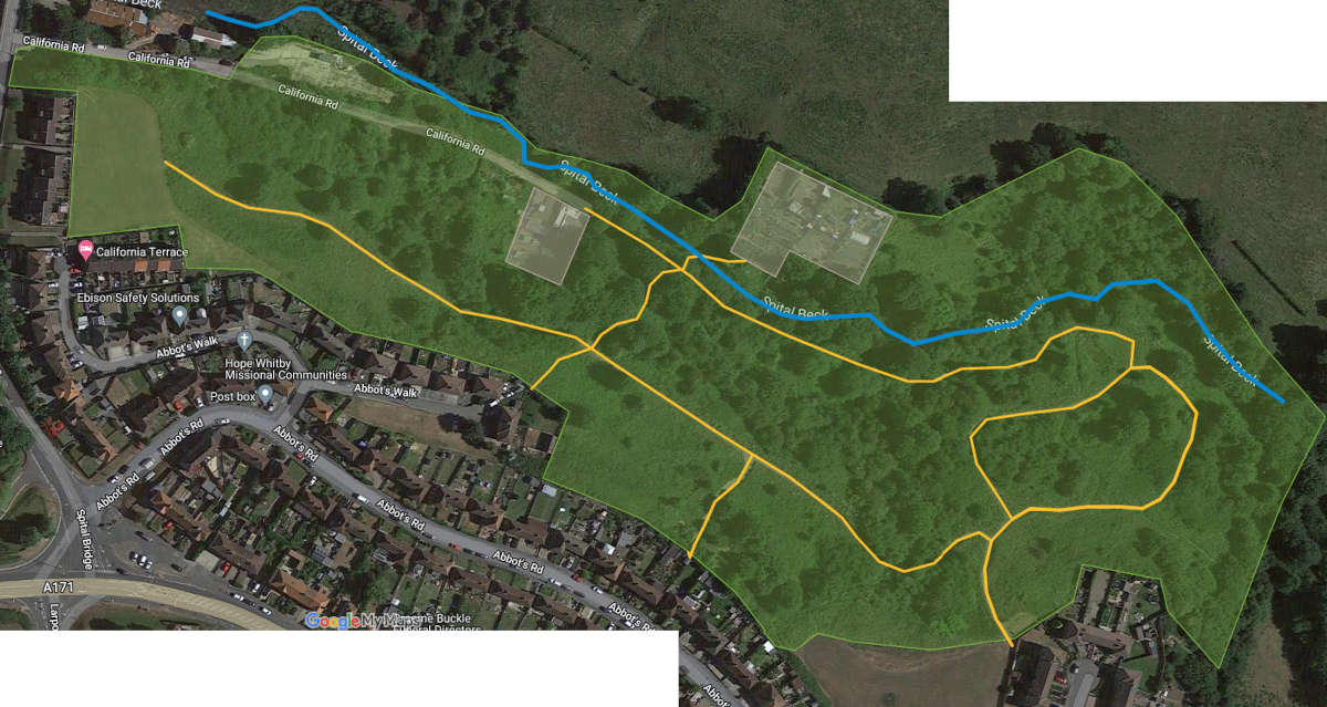
We should look at including the old council “tip” into this area; this maybe would involve removing the concrete base as well as the retaining fence and restoring in some way, perhaps for residents parking, or alternatively developing it for craft workshops?
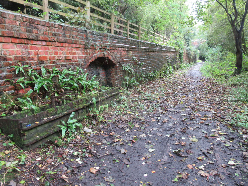
The “paths” are not well formed, and should be replaced with proper compacted gravel or the resin type used in Pannett Park, which would make it more accessible to all – though limiting the surfaced path to a loop through the area, and leaving all intermediate paths as grass would retain the natural feel of the area. More paths could be provided, steps and rails need improving, vegetation needs cutting back, benches need installing, and so on. In addition, our proposal for a cycle network has a cycle / walking path along the top end of Calla Beck, and subject to the LCWIP consultation exercise could potentially be open to funding from cycle infrastructure spend.
Note that SBC have been doing some work on Calla Beck as part of “Project Sunshine” in autumn 2022; there is no visibility of what their plan is – that is another problem with current green space provision, the utter lack of transparency and consultation.
5. Develop Stakesby Vale to improve quality and biodiversity
Stakesby Vale is of poor quality, not fully accessible, unsafe (crumbling steps, sloping muddy/icy paves, etc), and needs improvement.
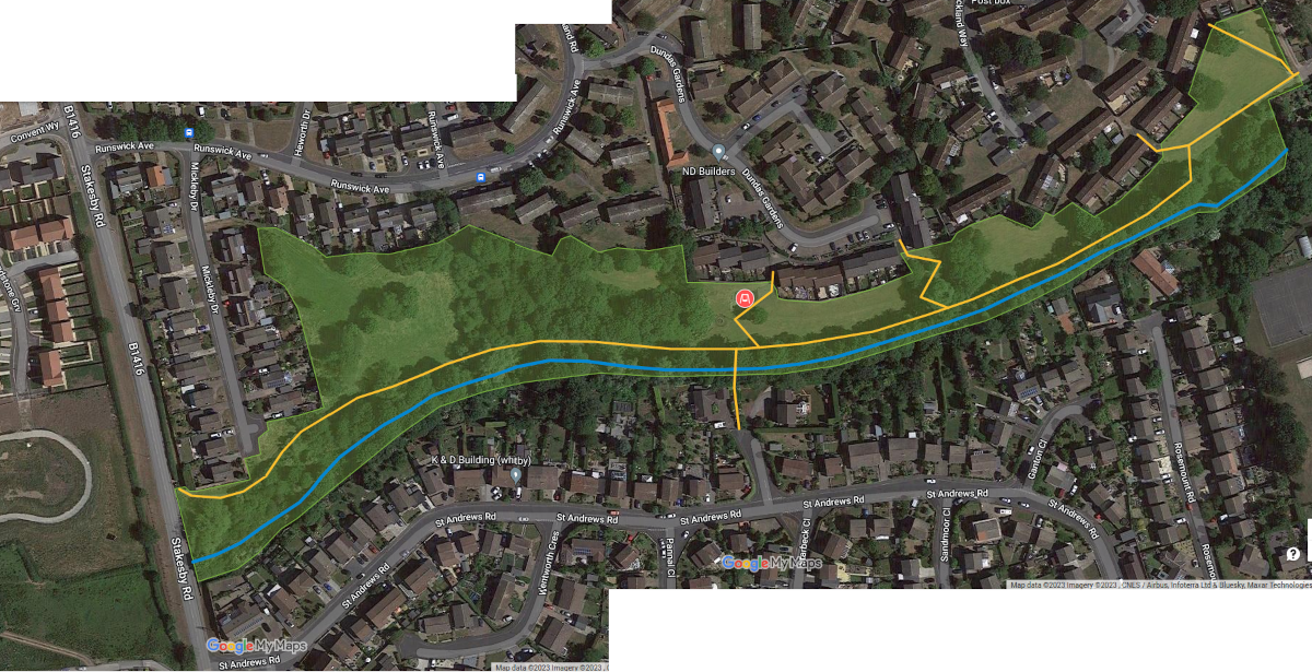
We clearly have a broad scope of what we want to make of this area. Here are some suggestions
- Replace the Play Park with something better, more fitting with the wooded environment. Note that NYC bulldozing of the previous play park in July 2023 means that this is top priority.
- Clear the beck area of fly tipping, and improve the water course. This may mean work on the banks to improve stability.
- The path along the beck needs replacing with a wide path suitable for pedestrians and people with bicycles (optionally segregate these two usages). The surface should be a form of compacted gravel or recycled tyres to minimise the problems with ice/frost compared to paves/tarmac. It should also be made usable by mobility vehicles. The steep bank just before Stakesby Vale road has a drainage issue that possibly needs remedying prior to path replacement. Note that this element could be available to be funded as cycling infrastructure, dependent on the consultation for the LCWIP.
- Lighting should cover the full length of Stakesby Vale. Consideration should go in to making the lighting motion sensitive, to minimise power, and reduce the impact on wildlife.
- The bridge across to Sunningdale Grove could be improved, even if it is just improving the entrance to it for people with bicycles.
- Benches should be installed along the length at intervals.
- The area where the old scout hut used to be (just before the Stakesby Vale road, next to the beck) could be thinned out and developed into a resource for the community, seating area? community orchard? adventure play area? In Oct 2023 NYC Parks dept thinned out the vegetation in this area to facilitate just this type of idea; our thanks go to them.
- Develop a wildflower meadow in at least one part of the area.
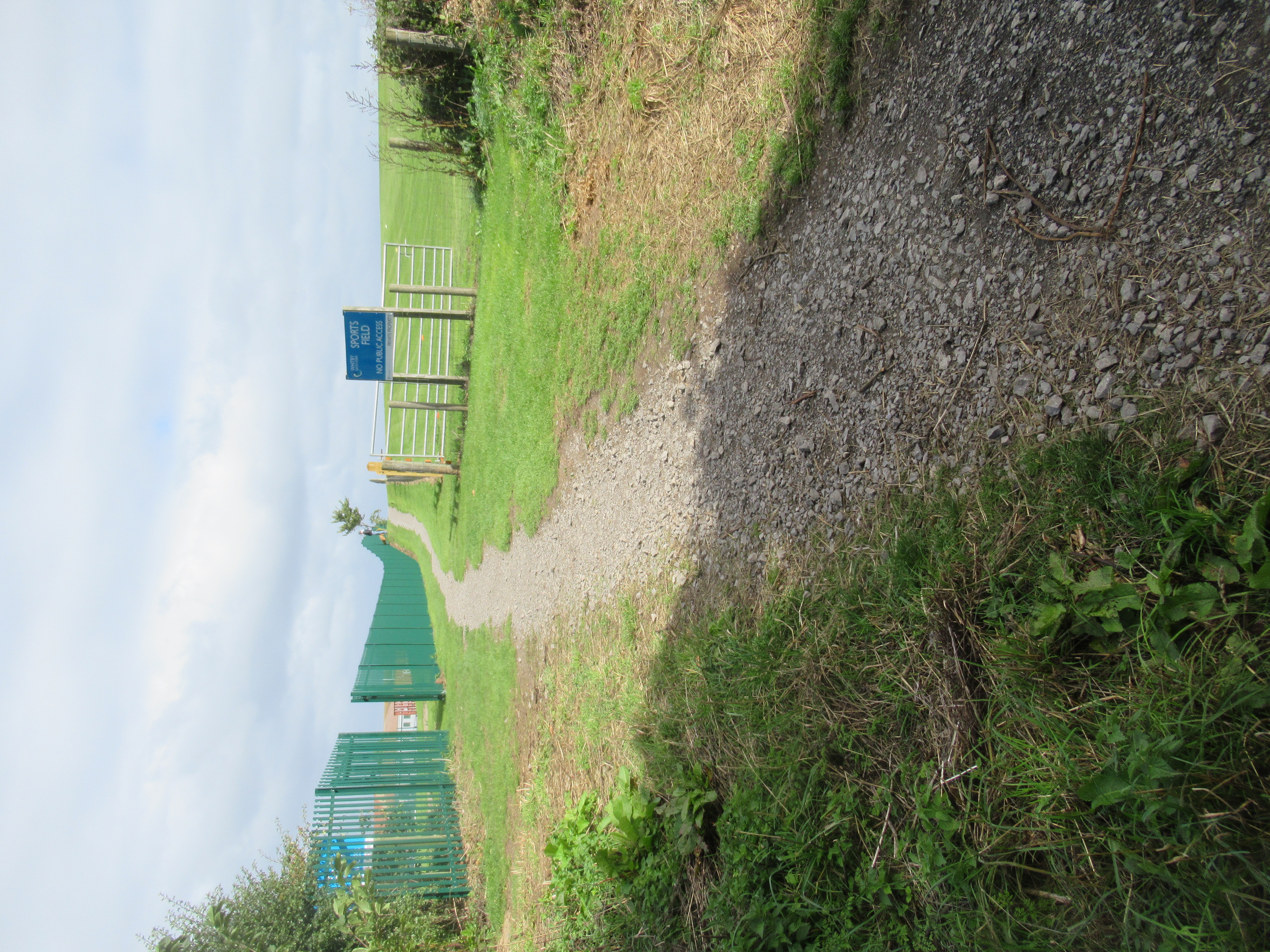
6. Provide more free-to-access Public Sports areas
To overcome the Sports shortfall, more publicly-accessible sports facilities should be provided in areas that aren’t currently with easy reach. This could be achieved by allocating a limited amount of the space at Caedmon College Sixth Form to be available for general use; for example the upper pitch closest to Mayfield Road / Prospect Hill could be made available. Bearing in mind that Caedmon College is only ~50% subscribed currently, it really ought to be possible to make some of the sports field space publicly accessible, which would help to overcome that particular category deficiency (this is complicated by the desire of the Whitby Secondary Partnership to close Eskdale School … which would lose even more (school) playing fields).
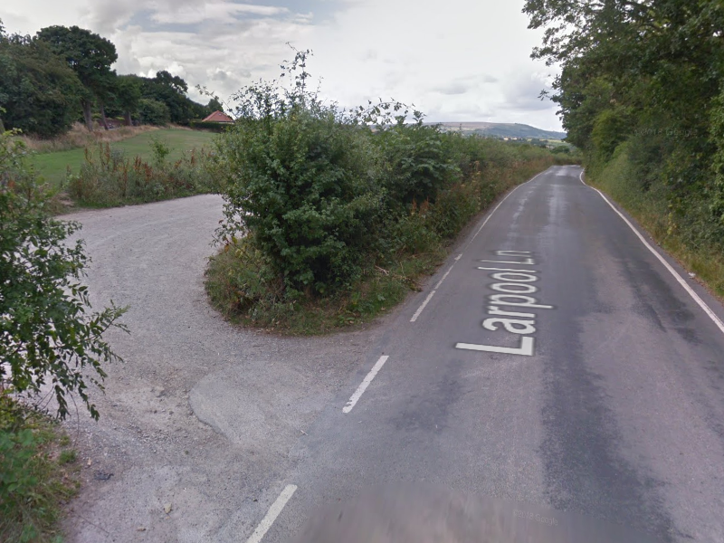
The order of 1000 dwellings in the Eskdale / Larpool area need free-to-access sports areas. The 3G pitch at Eskdale School is only for football (with particular footwear), is needed to be booked, and is not free-to-access. SBC are wanting to take away Larpool playing field (the only free-to-access playing field within easy reach). Larpool playing field could have football goals reinstated, and have benches added.
Mayfield area has no free-to-access sports area within a reasonable distance.
7. Develop a Country Park around the Viaduct
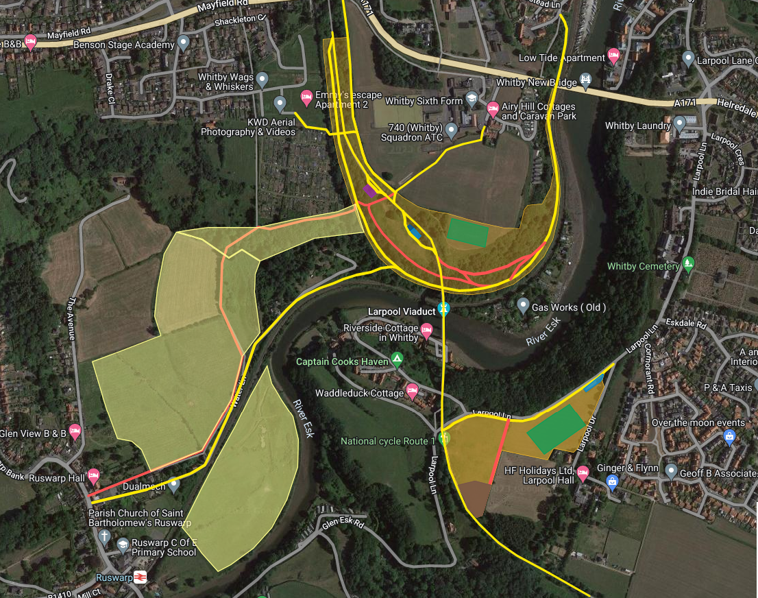
The land making up this proposed country park is comprised of
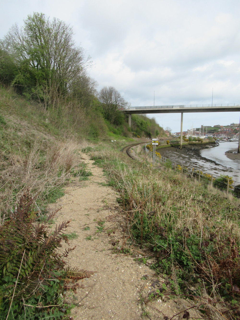
- CinderTrack – owned by NYC, north and south of the Larpool Viaduct.
- Prospect Hill line upper – owned by NYC, approximately as far as below the Larpool Viaduct.
- Prospect Hill line lower – owned by Network Rail from the track down to the live rail area, and owned by Caedmon College from the track up to the top. Land purchase required.
- Land above Prospect Hill line, but beyond playing fields – owned by Caedmon College (NYC).
- “Land lying to the east of Egremont House” – between CinderTrack and ProspectHill line (north of the viaduct), unused by its owners (bought in 2012, £30000), but occupied as a home for ponies. Land purchase required.
- “Land to the rear of Crowdy Hall Farm” – next to Larpool playing field, unused by its owners, but sometimes occupied as a home for ponies. Land purchase required.
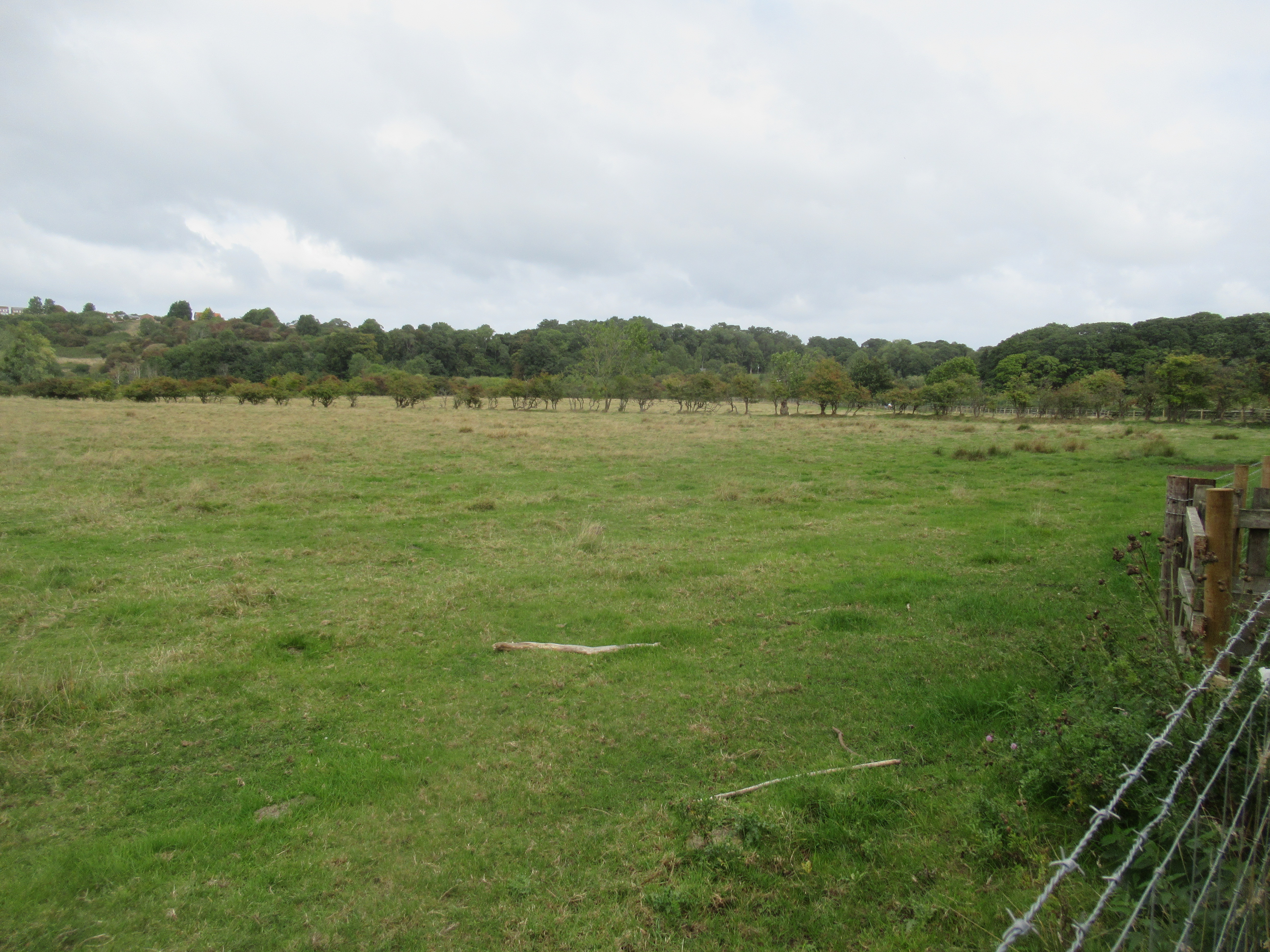
- Larpool Playing Field – owned by NYC, who wish to use it as a cemetery extension, despite the fact that it fails the conditions of such a usage.
- attract people to the location, so have a pleasant design and be easily accessible from residential areas
- convince people to spend time here, so things such as the cafe, plenty of seating, as well as attractions.
7.1 Country Park East
This section incorporates the existing Larpool playing field, together with the adjoining field. Amongst the components on this site, it will have a sports field, car park, as well as an access shared path for walking / cycling overcoming the dangerous road that is Larpool Lane. Having something like a large kids adventure playground would provide a great space for kids to enjoy themselves.
7.2 Country Park West
This section amalgamates several areas of land to the north of the Larpool Viaduct, providing a series of connected walking / cycling shared paths, allowing connection to residential, schools, as well as a traffic free route to the town centre. There is a significant scope for benches / seating areas on the Prospect Hill line, with great views of river, harbour, and viaduct. Alternative walking paths can be included in some places to reduce conflict between cyclists and pedestrians. The field space between CinderTrack and Prospect Hill line could be utilised by a cafe, with seating and bike parking, (free) water refill point for cyclists and walkers, and the idea of having a bike hub / recycling facility could be realised using this space also; this type of facility needs to be in a location readily accessible for all of the town, so near the viaduct makes most sense. The rear part (lower) playing field at the back of Caedmon College could be utilised as an additional free-to-access sports facility for kick-abouts, with benches etc.
8. Develop Urban Parks in East and West Side residential areas
To attempt to overcome the Urban Parks shortfall, there should be a concerted effort to develop such parks in the Helredale/Eskdale and Stakesby/Mayfield/Castle Park areas. Note that the current Local Plan already says (HC14)
“The creation of high quality open spaces and sports facilities and the improvement of existing open spaces and facilities for sport and recreation will be supported by […] allowing for the development of new or improved sites where it would not detract from the character and appearance of the surrounding area, including the character of the landscape, where appropriate; and requiring developers to make provision for open space through development, in line with the Borough Council’s adopted standards”.
The green space being allocated along with Broomfields Farm Phase 1, 2 and NetZero Village is labelled as Neighbourhood Park, as a result this could provide more than 6ha of urban park on the east side. It should be noted though that this is also labelled an “odour exclusion zone” around the water treatment works, so is not high quality green space. That then leaves provision of urban/neighbourhood park on the west side.
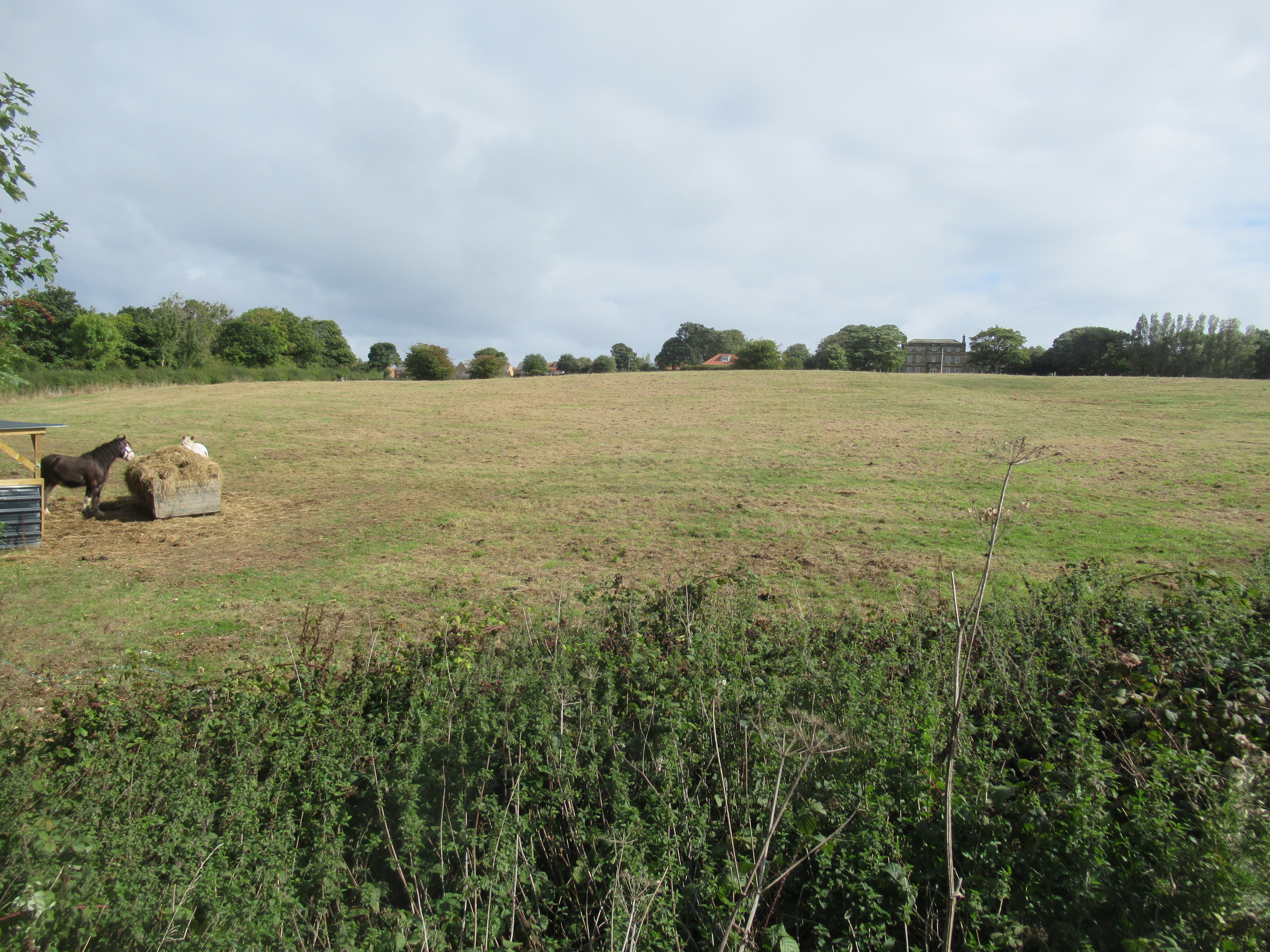
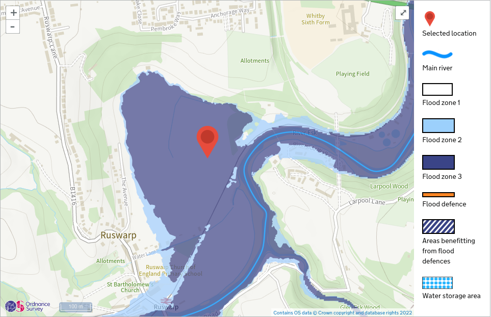
9. Develop Ruswarp Fields into a wetland
To overcome the Natural shortfall, one possible way to overcome this completely is Ruswarp Fields. This area is of significant interest from a wildlife perspective and is on a flood plain, and consequently would not obtain planning permission for any housing. The land value, as a result, is impacted. The area is within easy reach from Whitby residential for able-bodied, though better access could be provided. Please note that we are also proposing a walking / cycle path from the CinderTrack / Prospect Hill line that would run through this area, and would be an effective way of overcoming the access difficulties. It could be developed as a wetland and would completely provide for the deficiency in Natural green space, being the order of 15ha if the whole area was utilised. Another option is to consider just the section of land to the south of Water Lane up to the river (5.5ha).
10. Develop a Waterfront Urban Park
Whitby’s Waterfront urban park around the harbour and river should be protected from development as it is located on a level 3 flood plain, but be used as follows:
- Provide local fishing facilities
- Provision of green spaces and new shrub and tree planting
- Incorporate heritage, arts and culture into the urban park,
- Provide quality spaces to sit and relax, providing shelter and space for walks and trails.
- Be accessible, and provide community safety, food, beverage, sport and leisure opportunities.