The appalling state of transport in the Whitby District has been known about for years up here. The UK Government plans to cancel the northwestern branch of HS2 (they already cancelled the northeastern branch some time back), has resulted in something entitled “Network North”. The conservative candidate for York and North Yorkshire mayor, Cllr Keane Duncan, purportedly said
“Today signals a new era for Levelling Up and a turnaround moment for the future of the North – the whole North.
Rishi is changing politics and overturning decades of missed opportunities. No longer will one infrastructure project be allowed to distract from all others. No longer will the big cities forever dominate while more rural areas like ours miss out.
Rishi represents North Yorkshire. Like me, he believes in North Yorkshire. Together we are committed to delivering the road upgrades, rail links and bus services we desperately need and deserve – now, not in distant decades.“
As it stands currently there is no mention of Whitby and District in the whole document and we arguably have the worst public transport in the whole county. It may be early days for that document, developed to fit in with political events, but it currently doesn’t have anything in this district even vaguely in its sights (and also has South East and South West sections, so we’re not sure when they became part of “the north”), and while it has cover all wording like “projects could include …” this is vagueness that provides no surety of getting anything in this area ever. For the record, London and the south east has had the order of 3 times more spent on transport per head of population for the last 30 years.
Cllr Duncan, here is what Whitby Community Network asked at the recent NYC Area Committee meeting in Whitby.
I wonder how many of you came here by public transport …
We are told that people will need to use public transport or use a bike much more by 2030, using the car much less.
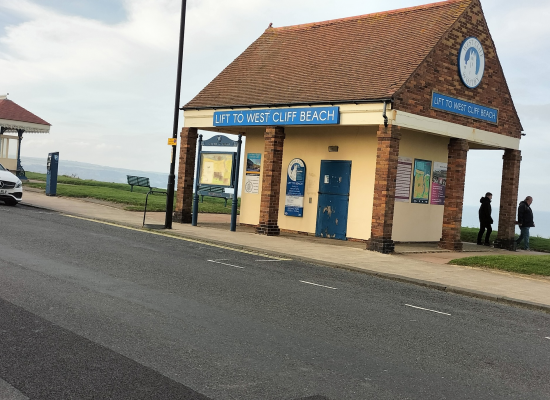
In Whitby district we currently have the sum total of 5 trains per day, travelling at a snails pace to Teesside, too late for people to get to work, and too late for early hospital appointments.
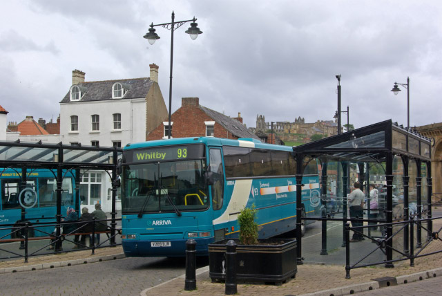
In terms of buses we have a service across the moors continually threatened with cancellation, routes to Scarborough / Middlesbrough and Loftus that have very frequent breakdowns, and a sole bus around Whitby that has now been decimated to only running once an hour and not at all on a Sunday or bank holiday and that doesn’t go anywhere near many parts of town. Many villages have no service at all. There are no direct services to any hospital.
For a district with a significantly ageing population this further stripping back of services beggars belief. Elderly people cannot stand at bus stops for often more than an hour on the off chance that an ageing Arriva bus has managed to arrive without going up in smoke, literally.
There is one bus service that is frequent, from the Park-and-Ride to town centre, but that is solely for the tourist, so of no benefit.
But that’s ok, we can always cycle … except we can’t because this council has invested the sum total of £0 in cycle infrastructure in the Whitby district; we have amongst the lowest levels of cycle infra and cycling in the whole of North Yorkshire.
The inadequate public transport service also means that the much vaunted tourist will most likely just come here in their car and consequently clog up the streets, parking on scarce green space that is supposed to be for recreation. Parking on green space being a side effect of the current NYC “parking strategy” that is not fit for an era of mass tourism, and was promised to be reviewed more than 5 years ago … still waiting for that one.
When will North Yorkshire Council actually engage with the Whitby and District community on each and every one of these problems so people can start to believe that Northallerton isn’t simply an artificial intelligence verbiage generation experiment?
Please, residents need action, not words, and not in 2030 either.
So we repeat the question. Cllr Duncan, where is the action that Rishi is going to provide “now”, for Whitby and District, if he really believes in this area? Or do we have to wait for “distant decades” for any action ?
Cllr Duncan kindly replied on 15th Oct 2023, as follows
Thank you for raising this with me.
Recent positives include the £2 fare cap extension and £2.9m of extra bus support. The Government has also committed to devolving new transport powers and funding to North Yorkshire under the devolution deal. This represents a major step forward for our region.
However, more needs to be done. The big cities have attracted billions in transport investment, while more rural areas like ours have received comparatively little.
This situation needs to be overturned and I will outline, in due course, my manifesto proposals to achieve this.
I will formally consult Whitby Community Network to ensure that your views are encapsulated.
Many thanks,
Cllr Keane Duncan