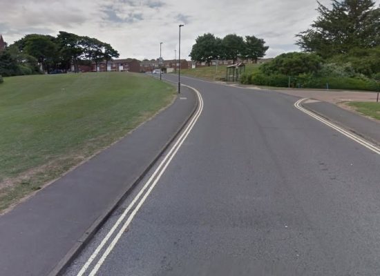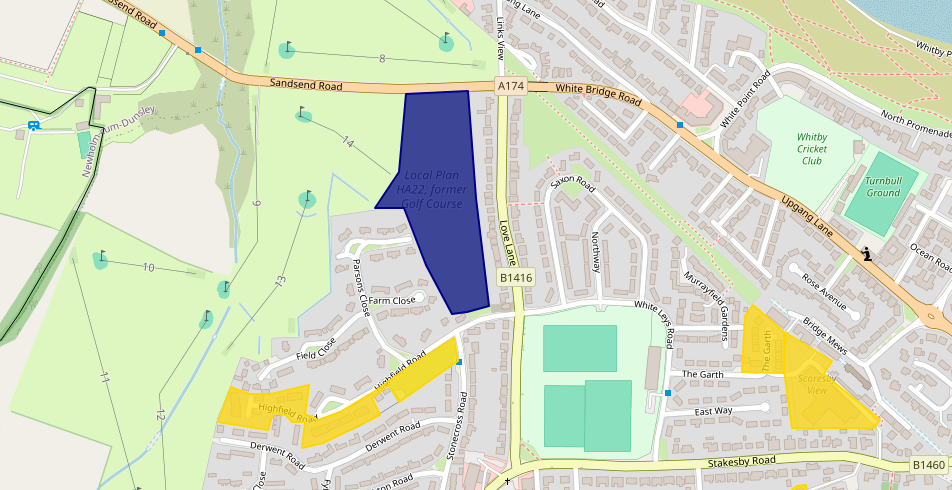
The SBC Local Plan of 2017 listed area HA22, formerly part of Whitby Golf Course, to be developed for housing. This represents 2.8ha of green belt.
A meeting of the NYC Executive on 14/07/2026 will aim to approve a joint venture with Lovell Homes (item 8 on the agenda). This meeting will additionally agree to the disposal of two areas of NYC owned land, the land off Sandsend Road (known as HA22 in the Local Plan), and an area in Eastfield. The report for this item is HERE.
NYC Support for the Housing
The (SBC) Local Plan says that this development would only be supported if
- The site will be accessed off Sandsend Road with an option for a secondary access from Highfield Road;
- The development of this site will only be supported where it is demonstrated that it will contribute to the longer term future of the Golf Course whilst also allowing the retention of its 18 hole status through a suitable re configuration of the course;
- Development should be outwardly facing with appropriate open space provided between the residential development and the golf course in order to provide an attractive residential environment and entrance to Whitby.
One part of the remains of Whitby Golf Course is currently feeling the effects of coastal erosion, with zero protection provided by NYC and the Environment Agency. Additionally NYC would not provide any support for replacement of the ravine bridge, further affecting the viability of Whitby Golf Course. It can be argued that condition 2 is not met.
Housing Suitability
As part of the Whitby Neighbourhood Plan, we had a “Housing Needs Assessment” performed. This identified affordable housing as being the critical provision needed, with a smaller amount of housing suitable for elderly. The statement in this “joint venture” does not define what housing will be provided, other than it will be the standard Local Plan 30% of dwellings as “affordable”. Given that this is a joint venture, it would be reasonable to have expected significantly more affordable.
The other aspect of the announcement states that it is for an indicative 60 dwellings. The indicative number could change by the time of submitting plans (as happened on Broomfield developments), but we have to use the 60 number for now. Given that the site is of some 2.8ha, that would represent a low density of dwellings. If we compare with other recent developments
- Barratts “Prospect Rise” : 72 dwellings in 2.3ha – 0.032 ha/dwelling.
- David Wilson “Eskdale Park” : 194 dwellings in 6.3ha – 0.032 ha/dwelling.
- Sneaton Castle estate : 236 dwellings (+ 1 care home) in 6.8ha – 0.029 ha/dwelling.
- Barratts “Abbey View” : 233 dwellings in 7.7ha – 0.033 ha/dwelling.
- HA22 : 60 dwellings in 2.8ha – 0.046 ha/dwelling.
If only realising 60 dwellings on scarce land in the Whitby parish that signifies poor utilisation of land. Or maybe this location and the low density is purely indicative of being a money spinner for NYC, to pull money in from their share of the profits and do little to address the town’s problems? After all, they pull in a large share of their second homes money from Whitby and, thus far, none of that money has been invested in fixing the housing issues here.
Other factors
- The Whitby Neighbourhood Plan was submitted to NYC (REG16) at the start of July 2026. It would be expected that this plan is adopted (“made”) by Spring 2027. That would imply that components of the Neighbourhood Plan would be in force, such as primary residence in perpetuity for all new builds, 50% discount on “First Homes” scheme, etc.
It reemains to be seen if/when NYC approve this joint venture, and what plans they actually come up with for this development.
Will it do anything to meet the recent Housing Needs Assessment?
Will it increase the amount of “affordable” to address one of the critical problems present in the town?